Division of Spence
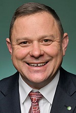
Division of Spence is a federal electorate in South Australia, covering about 534 km². Its federal member is Matt Burnell (Australian Labor Party). State electorates overlapping it include Taylor, Schubert, Light, King. Local council areas overlapping it include City of Playford, City of Salisbury, Town of Gawler, The Barossa Council.
- Level
- Federal electorate
- State / territory
- South Australia (SA)
- Area
- about 534 km²
- Federal member
- Matt Burnell — Australian Labor Party
- Official source
- AEC electorate profile
On Political Gadgets
State electorates overlapping Spence
| Taylor (SA state electorate) | 41% of this federal electorate | 91% of Taylor |
| Schubert (SA state electorate) | 25% of this federal electorate | 6% of Schubert |
| Light (SA state electorate) | 10% of this federal electorate | >99% of Light |
| King (SA state electorate) | 8% of this federal electorate | 53% of King |
| Ramsay (SA state electorate) | 5% of this federal electorate | >99% of Ramsay |
| Elizabeth (SA state electorate) | 5% of this federal electorate | >99% of Elizabeth |
| Ngadjuri (SA state electorate) | 4% of this federal electorate | <1% of Ngadjuri |
| Playford (SA state electorate) | 1% of this federal electorate | 40% of Playford |
Local council areas overlapping Spence
| City of Playford | 65% of this federal electorate | 96% of City of Playford |
| City of Salisbury | 16% of this federal electorate | 52% of City of Salisbury |
| Town of Gawler | 8% of this federal electorate | >99% of Town of Gawler |
| The Barossa Council | 7% of this federal electorate | 4% of The Barossa Council |
| Light Regional Council | 4% of this federal electorate | 2% of Light Regional Council |
Suburbs in Spence
Suburbs with at least a quarter of their area inside this federal electorate. Select one to see all three levels of electorate.
- Andrews Farm 5114
- Angle Vale 5117
- Bibaringa 5118
- Blakeview 5114
- Bolivar 5110
- Brahma Lodge 5109
- Buchfelde 5118
- Buckland Park 5120
- Burton 5110
- Concordia 5118
- Craigmore 5114
- Davoren Park 5113
- Direk 5110
- Edinburgh 5111
- Edinburgh North 5113
- Elizabeth 5112
- Elizabeth Downs 5113
- Elizabeth East 5112
- Elizabeth Grove 5112
- Elizabeth North 5113
- Elizabeth Park 5113
- Elizabeth South 5112
- Elizabeth Vale 5112
- Evanston 5116
- Evanston Gardens 5116
- Evanston Park 5116
- Evanston South 5116
- Eyre 5121
- Gawler 5118
- Gawler Belt 5118
- Gawler East 5118
- Gawler South 5118
- Gawler West 5118
- Gould Creek 5114
- Hewett 5118
- Hillbank 5112
- Hillier 5116
- Humbug Scrub 5114
- Kalbeeba 5118
- Kudla 5115
- Macdonald Park 5121
- Munno Para 5115
- Munno Para Downs 5115
- Munno Para West 5115
- One Tree Hill 5114
- Paralowie 5108
- Penfield 5121
- Penfield Gardens 5121
- Reid 5118
- Salisbury 5108
- Salisbury Downs 5108
- Salisbury North 5108
- Salisbury Park 5109
- Salisbury Plain 5109
- Salisbury South 5106
- Sampson Flat 5114
- Smithfield 5114
- Smithfield Plains 5114
- St Kilda 5110
- Uleybury 5114
- Virginia 5120
- Waterloo Corner 5110
- Willaston 5118
- Yattalunga 5114
Questions
Who is the federal member for Spence?
Matt Burnell of the Australian Labor Party is the federal member for the Division of Spence in the House of Representatives.
Which council areas are in the Division of Spence?
Council areas overlapping it include City of Playford, City of Salisbury, Town of Gawler, The Barossa Council, Light Regional Council.
Which state electorates are in the Division of Spence?
State electorates overlapping it include Taylor, Schubert, Light, King, Ramsay, Elizabeth.
Which suburbs are in Spence?
Suburbs mostly inside it include Andrews Farm, Bibaringa, Blakeview, Brahma Lodge, Buchfelde, Burton, Craigmore, Davoren Park.
How accurate is this?
Boundaries are simplified (about 40 m tolerance), so overlap percentages are approximate. For anything official, such as enrolment or voting, check the Australian Electoral Commission or your state electoral commission.
← All federal electorates · Find My Electorates
Federal boundaries: Australian Electoral Commission (as at the 2025 federal election). State and council boundaries: incorporates or developed using Administrative Boundaries © Geoscape Australia licensed under CC BY 4.0.