Division of Farrer
Division of Farrer is a federal electorate in New South Wales, covering about 126,561 km². Its federal member is David Farley (Pauline Hanson's One Nation Party). State electorates overlapping it include Murray, Albury, Cootamundra. Local council areas overlapping it include Wentworth Shire Council, Balranald Shire Council, Carrathool Shire Council, Murray River Council.
- Level
- Federal electorate
- State / territory
- New South Wales (NSW)
- Area
- about 126,561 km²
- Federal member
- David Farley — Pauline Hanson's One Nation Party
- Official source
- AEC electorate profile
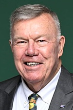
On Political Gadgets
State electorates overlapping Farrer
| Murray (NSW state electorate) | 87% of this federal electorate | >99% of Murray |
| Albury (NSW state electorate) | 9% of this federal electorate | 72% of Albury |
| Cootamundra (NSW state electorate) | 3% of this federal electorate | 11% of Cootamundra |
Local council areas overlapping Farrer
| Wentworth Shire Council | 21% of this federal electorate | >99% of Wentworth Shire Council |
| Balranald Shire Council | 17% of this federal electorate | >99% of Balranald Shire Council |
| Carrathool Shire Council | 15% of this federal electorate | >99% of Carrathool Shire Council |
| Murray River Council | 9% of this federal electorate | >99% of Murray River Council |
| Hay Shire Council | 9% of this federal electorate | >99% of Hay Shire Council |
| Edward River Council | 7% of this federal electorate | >99% of Edward River Council |
| Murrumbidgee Council | 5% of this federal electorate | >99% of Murrumbidgee Council |
| Greater Hume Shire Council | 5% of this federal electorate | >99% of Greater Hume Shire Council |
| Federation Council | 4% of this federal electorate | >99% of Federation Council |
| Narrandera Shire Council | 3% of this federal electorate | >99% of Narrandera Shire Council |
| Berrigan Shire Council | 2% of this federal electorate | >99% of Berrigan Shire Council |
| Griffith City Council | 1% of this federal electorate | >99% of Griffith City Council |
| Leeton Shire Council | <1% of this federal electorate | >99% of Leeton Shire Council |
| Albury City Council | <1% of this federal electorate | >99% of Albury City Council |
Suburbs in Farrer
Suburbs with at least a quarter of their area inside this federal electorate. Select one to see all three levels of electorate.
- Albury 2640
- Alma Park 2659
- Anabranch North 2648
- Anabranch South 2648
- Aratula 2714
- Argoon 2707
- Arumpo 2715
- Balldale 2646
- Balranald 2715
- Barellan 2665
- Barham 2732
- Barooga 3644
- Barratta 2710
- Beelbangera 2680
- Benerembah 2680
- Berrigan 2712
- Bilbul 2680
- Binya 2665
- Birganbigil 2710
- Blighty 2713
- Boeill Creek 2739
- Booligal 2711
- Boomanoomana 2712
- Boorga 2652
- Booroorban 2710
- Boree Creek 2652
- Bowna 2644
- Brobenah 2705
- Brocklesby 2642
- Bullatale 2710
- Bundure 2716
- Bungowannah 2640
- Bunnaloo 2731
- Buronga 2739
- Burraboi 2732
- Burrumbuttock 2642
- Caldwell 2710
- Calimo 2710
- Carabost 2650
- Carrathool 2711
- Clare 2711
- Cobramunga 2732
- Coleambally 2707
- Colinroobie 2700
- Collendina 2646
- Conargo 2710
- Cookardinia 2650
- Coomealla 2717
- Coppabella 2644
- Corbie Hill 2705
- Coree 2710
- Coreen 2646
- Corobimilla 2700
- Corowa 2646
- Corrong 2711
- Cudgel 2700
- Culcairn 2660
- Cunninyeuk 2734
- Curlwaa 2648
- Dareton 2717
- Darlington Point 2706
- Daysdale 2646
- Deniliquin 2710
- Dhuragoon 2733
- Dilpurra 2734
- East Albury 2640
- Ellerslie (Wentworth) 2648
- Erigolia 2669
- Ettamogah 2640
- Euroley 2700
- Euston 2737
- Finley 2713
- Four Corners 2716
- Gala Vale 2716
- Galore 2650
- Gerogery 2642
- Gillenbah 2700
- Glenellen 2642
- Glenroy (Albury) 2640
- Gogeldrie 2705
- Gol Gol 2738
- Gonn 2732
- Goodnight 2736
- Goolgowi 2652
- Goombargana 2646
- Griffith 2680
- Grong Grong 2652
- Gunbar 2711
- Hamilton Valley 2641
- Hanwood 2680
- Hartwood 2710
- Hatfield 2715
- Hay 2711
- Hay South 2711
- Henty 2658
- Hillston 2675
- Holbrook 2644
- Hopefield 2646
- Howlong 2643
- Jerilderie 2716
- Jindera 2642
- Jingellic 2642
- Kamarah 2665
- Keri Keri 2711
- Kooba 2680
- Koraleigh 2735
- Kyalite 2715
- Lake Brewster 2675
- Lake Hume Village 3691
- Lake Wyangan 2680
- Lalalty 3644
- Landervale 2652
- Lankeys Creek 2644
- Lavington 2641
- Leeton 2705
- Lindifferon 2710
- Little Billabong 2644
- Logie Brae 2713
- Lowesdale 2646
- Mabins Well 2716
- Mairjimmy 2716
- Mallan 2734
- Mallee 2738
- Mathoura 2710
- Maude 2711
- Mayrung 2710
- Melbergen 2669
- Mellool 2734
- Merriwagga 2652
- Merungle Hill 2705
- Moama 2731
- Monak 2738
- Monia Gap 2675
- Moolpa 2734
- Moombooldool 2665
- Moonbria 2710
- Moorara 2648
- Moorwatha 2640
- Morago 2710
- Morundah 2700
- Morven (Greater Hume Shire) 2660
- Mossgiel 2878
- Moulamein 2733
- Mountain Creek 2644
- Mourquong 2739
- Mullengandra 2644
- Mulwala 2647
- Mungo 2715
- Murrami 2705
- Murray Downs 2734
- Myall Park 2681
- Myrtle Park 2713
- Narrandera 2700
- Nericon 2680
- Niemur 2733
- Noorong 2732
- North Albury 2640
- Nyora 2646
- Oaklands 2646
- One Tree 2711
- Oxley (Balranald) 2711
- Pan Ban 2648
- Para 2648
- Paringi 2738
- Pine Camp 2648
- Pine Lodge 2714
- Pomona 2648
- Pooncarie 2648
- Pretty Pine 2710
- Rand 2642
- Rankins Springs 2669
- Redlands 2646
- Rennie 2646
- Ringwood 2646
- Rosewood (Snowy Valleys) 2652
- Roto 2675
- Rufus 2648
- Sandigo 2700
- Sanger 2646
- Savernake 2646
- Scotia 2648
- South Albury 2640
- Speewa 2735
- Splitters Creek 2640
- Springdale Heights 2641
- Stanbridge 2705
- Steam Plains 2710
- Stony Crossing 2734
- Stud Park 2710
- Tabbita 2652
- Table Top 2640
- Talmalmo 2640
- Tantonan 2731
- Tharbogang 2680
- Thule 2732
- Thurgoona 2640
- Thyra 2731
- Tocumwal 2714
- Tooleybuc 2736
- Tooranie 2734
- Trentham Cliffs 2738
- Tullakool 2732
- Tuppal 2714
- Urana 2645
- Wakool 2710
- Walbundrie 2642
- Walla Walla 2659
- Wallanthery 2675
- Wandook 2710
- Wanganella 2710
- Wantagong 2644
- Warburn 2680
- Warragoon 2710
- Warrawidgee 2680
- Waugorah 2711
- Wentworth 2648
- West Albury 2640
- Wetuppa 2734
- Whitton 2705
- Widgelli 2680
- Willbriggie 2680
- Willurah 2710
- Wirlinga 2640
- Womboota 2731
- Woomargama 2644
- Wymah 2640
- Yanco 2703
- Yanga 2711
- Yarara 2644
- Yenda 2681
- Yoogali 2680
Questions
Who is the federal member for Farrer?
David Farley of the Pauline Hanson's One Nation Party is the federal member for the Division of Farrer in the House of Representatives.
Which council areas are in the Division of Farrer?
Council areas overlapping it include Wentworth Shire Council, Balranald Shire Council, Carrathool Shire Council, Murray River Council, Hay Shire Council, Edward River Council.
Which state electorates are in the Division of Farrer?
State electorates overlapping it include Murray, Albury, Cootamundra.
Which suburbs are in Farrer?
Suburbs mostly inside it include Anabranch North, Anabranch South, Argoon, Arumpo, Balldale, Barratta, Beelbangera, Benerembah.
How accurate is this?
Boundaries are simplified (about 40 m tolerance), so overlap percentages are approximate. For anything official, such as enrolment or voting, check the Australian Electoral Commission or your state electoral commission.
← All federal electorates · Find My Electorates
Federal boundaries: Australian Electoral Commission (as at the 2025 federal election). State and council boundaries: incorporates or developed using Administrative Boundaries © Geoscape Australia licensed under CC BY 4.0.