Division of Braddon
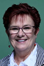
Division of Braddon is a federal electorate in Tasmania, covering about 21,368 km². Its federal member is Anne Urquhart (Australian Labor Party). State electorates overlapping it include Braddon. Local council areas overlapping it include West Coast Council, Circular Head Council, Waratah-Wynyard Council, King Island Council.
- Level
- Federal electorate
- State / territory
- Tasmania (TAS)
- Area
- about 21,368 km²
- Federal member
- Anne Urquhart — Australian Labor Party
- Official source
- AEC electorate profile
On Political Gadgets
State electorates overlapping Braddon
| Braddon (TAS state electorate) | >99% of this federal electorate | 97% of Braddon |
Local council areas overlapping Braddon
| West Coast Council | 45% of this federal electorate | 97% of West Coast Council |
| Circular Head Council | 23% of this federal electorate | 96% of Circular Head Council |
| Waratah-Wynyard Council | 17% of this federal electorate | >99% of Waratah-Wynyard Council |
| King Island Council | 5% of this federal electorate | >99% of King Island Council |
| Central Coast Council | 4% of this federal electorate | >99% of Central Coast Council |
| Burnie City Council | 3% of this federal electorate | >99% of Burnie City Council |
| Latrobe Council | 3% of this federal electorate | 96% of Latrobe Council |
| Devonport City Council | <1% of this federal electorate | 96% of Devonport City Council |
Suburbs in Braddon
Suburbs with at least a quarter of their area inside this federal electorate. Select one to see all three levels of electorate.
- Abbotsham 7315
- Aberdeen 7310
- Acton 7320
- Alcomie 7330
- Ambleside 7310
- Arthur River 7330
- Bakers Beach 7307
- Black River 7321
- Boat Harbour 7321
- Boat Harbour Beach 7321
- Brittons Swamp 7330
- Broadmeadows 7330
- Brooklyn 7320
- Bungaree 7256
- Burnie 7320
- Calder 7325
- Camdale 7320
- Camena 7316
- Castra 7315
- Chasm Creek 7321
- Christmas Hills 7330
- Cooee 7320
- Corinna 7321
- Couta Rocks 7330
- Cowrie Point 7321
- Cradle Mountain 7306
- Crayfish Creek 7321
- Cuprona 7316
- Currie 7256
- Detention 7321
- Devonport 7310
- Doctors Rocks 7325
- Don 7310
- Downlands 7320
- East Cam 7321
- East Devonport 7310
- East Ridgley 7321
- Edgcumbe Beach 7321
- Edith Creek 7330
- Egg Lagoon 7256
- Elliott 7325
- Emu Heights 7320
- Eugenana 7310
- Flowerdale 7325
- Forest 7330
- Forth 7310
- Forthside 7310
- Frankford 7275
- Gawler 7315
- Gormanston 7466
- Granville Harbour 7469
- Grassy 7256
- Guildford 7321
- Gunns Plains 7315
- Hampshire 7321
- Harford 7307
- Havenview 7320
- Hawley Beach 7307
- Hellyer 7321
- Henrietta 7325
- Heybridge 7316
- Highclere 7321
- Hillcrest 7320
- Howth 7316
- Irishtown 7330
- Kindred 7310
- Lake Margaret 7467
- Lake St Clair 7140
- Lapoinya 7325
- Latrobe 7307
- Leith 7315
- Lileah 7330
- Lillico 7310
- Loongana 7315
- Loorana 7256
- Loyetea 7316
- Luina 7321
- Lymwood 7256
- Macquarie Heads 7116
- Marrawah 7330
- Mawbanna 7321
- Mella 7330
- Melrose 7310
- Mengha 7330
- Merseylea 7305
- Meunna 7325
- Miandetta 7310
- Milabena 7325
- Montagu 7330
- Montello 7320
- Montumana 7321
- Mooreville 7321
- Moorleah 7325
- Moriarty 7307
- Mount Hicks 7325
- Myalla 7325
- Nabageena 7330
- Naracoopa 7256
- Natone 7321
- Nelson Bay 7330
- Nietta 7315
- North Motton 7315
- Northdown 7307
- Nugara 7256
- Ocean Vista 7320
- Oldina 7325
- Oonah 7325
- Paloona 7310
- Park Grove 7320
- Parklands 7320
- Parrawe 7321
- Pearshape 7256
- Pegarah 7256
- Penguin 7316
- Port Latta 7321
- Port Sorell 7307
- Preolenna 7325
- Preservation Bay 7316
- Preston 7315
- Queenstown 7467
- Quoiba 7310
- Redpa 7330
- Reekara 7256
- Renison Bell 7469
- Riana 7316
- Ridgley 7321
- Rocky Cape 7321
- Roger River 7330
- Romaine 7320
- Rosebery 7470
- Round Hill 7320
- Sassafras 7307
- Savage River 7321
- Scopus 7330
- Scotchtown 7330
- Sea Elephant 7256
- Shearwater 7307
- Shorewell Park 7320
- Sisters Beach 7321
- Sisters Creek 7325
- Smithton 7330
- Somerset 7322
- South Burnie 7320
- South Forest 7330
- South Nietta 7315
- South Preston 7315
- South Riana 7316
- Southwest 7116
- Spalford 7315
- Sprent 7315
- Spreyton 7310
- Squeaking Point 7307
- Stanley 7331
- Stony Rise 7310
- Stowport 7321
- Strahan 7468
- Sulphur Creek 7316
- Surprise Bay 7256
- Table Cape 7325
- Takone 7325
- Tarleton 7310
- Temma 7330
- Tewkesbury 7321
- Thirlstane 7307
- Togari 7330
- Trial Harbour 7469
- Trowutta 7330
- Tugrah 7310
- Tullah 7321
- Turners Beach 7315
- Ulverstone 7315
- Upper Burnie 7320
- Upper Castra 7315
- Upper Natone 7321
- Upper Stowport 7321
- Waratah 7321
- Wesley Vale 7307
- West Coast 7469
- West Montagu 7330
- West Mooreville 7321
- West Pine 7316
- West Ridgley 7321
- West Takone 7325
- West Ulverstone 7315
- Wickham 7256
- Wiltshire 7321
- Wivenhoe 7320
- Woolnorth 7330
- Wynyard 7325
- Yambacoona 7256
- Yarra Creek 7256
- Yolla 7325
- Zeehan 7469
Questions
Who is the federal member for Braddon?
Anne Urquhart of the Australian Labor Party is the federal member for the Division of Braddon in the House of Representatives.
Which council areas are in the Division of Braddon?
Council areas overlapping it include West Coast Council, Circular Head Council, Waratah-Wynyard Council, King Island Council, Central Coast Council, Burnie City Council.
Which state electorates are in the Division of Braddon?
State electorates overlapping it include Braddon.
Which suburbs are in Braddon?
Suburbs mostly inside it include Abbotsham, Acton, Alcomie, Brittons Swamp, Broadmeadows, Brooklyn, Bungaree, Calder.
How accurate is this?
Boundaries are simplified (about 40 m tolerance), so overlap percentages are approximate. For anything official, such as enrolment or voting, check the Australian Electoral Commission or your state electoral commission.
← All federal electorates · Find My Electorates
Federal boundaries: Australian Electoral Commission (as at the 2025 federal election). State and council boundaries: incorporates or developed using Administrative Boundaries © Geoscape Australia licensed under CC BY 4.0.