Division of Wide Bay
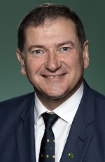
Division of Wide Bay is a federal electorate in Queensland, covering about 14,602 km². Its federal member is Llew O'Brien (Liberal National Party). State electorates overlapping it include Gympie, Maryborough, Nanango, Hervey Bay. Local council areas overlapping it include Gympie Regional, Fraser Coast Regional, Noosa Shire, South Burnett Regional.
- Level
- Federal electorate
- State / territory
- Queensland (QLD)
- Area
- about 14,602 km²
- Federal member
- Llew O'Brien — Liberal National Party
- Official source
- AEC electorate profile
On Political Gadgets
State electorates overlapping Wide Bay
| Gympie (QLD state electorate) | 32% of this federal electorate | >99% of Gympie |
| Maryborough (QLD state electorate) | 25% of this federal electorate | 75% of Maryborough |
| Nanango (QLD state electorate) | 24% of this federal electorate | 20% of Nanango |
| Hervey Bay (QLD state electorate) | 12% of this federal electorate | 72% of Hervey Bay |
| Noosa (QLD state electorate) | 5% of this federal electorate | >99% of Noosa |
| Nicklin (QLD state electorate) | <1% of this federal electorate | 21% of Nicklin |
Local council areas overlapping Wide Bay
| Gympie Regional | 47% of this federal electorate | >99% of Gympie Regional |
| Fraser Coast Regional | 42% of this federal electorate | 76% of Fraser Coast Regional |
| Noosa Shire | 6% of this federal electorate | >99% of Noosa Shire |
| South Burnett Regional | 5% of this federal electorate | 8% of South Burnett Regional |
| Cherbourg Aboriginal Shire | <1% of this federal electorate | 99% of Cherbourg Aboriginal Shire |
Suburbs in Wide Bay
Suburbs with at least a quarter of their area inside this federal electorate. Select one to see all three levels of electorate.
- Aldershot 4650
- Amamoor 4570
- Amamoor Creek 4570
- Anderleigh 4570
- Antigua 4650
- Araluen 4570
- Aramara 4620
- Banks Pocket 4570
- Barambah 4601
- Barlil 4605
- Bauple 4650
- Bauple Forest 4650
- Beaver Rock 4650
- Beenaam Valley 4570
- Bella Creek 4570
- Bells Bridge 4570
- Bidwill 4650
- Black Mountain 4563
- Black Snake 4600
- Bollier 4570
- Boompa 4621
- Boonara 4601
- Boonooroo 4650
- Boonooroo Plains 4650
- Booubyjan 4601
- Boreen Point 4565
- Brooloo 4570
- Brooweena 4620
- Byee 4605
- Calgoa 4570
- Calico Creek 4570
- Canina 4570
- Carters Ridge 4563
- Castaways Beach 4567
- Cedar Pocket 4570
- Chatsworth 4570
- Cherbourg 4605
- Cinnabar 4600
- Cloyna 4605
- Cobbs Hill 4605
- Coles Creek 4570
- Como 4571
- Cooloola 4580
- Cooloola Cove 4580
- Coondoo 4570
- Cooran 4569
- Cooroibah 4565
- Cooroy 4563
- Cooroy Mountain 4563
- Cootharaba 4565
- Corella 4570
- Crownthorpe 4605
- Curra 4570
- Dagun 4570
- Doonan 4562
- Doongul 4620
- Downsfield 4570
- Dunmora 4650
- East Deep Creek 4570
- Elgin Vale 4615
- Eurong 4581
- Federal 4568
- Ferney 4650
- Fishermans Pocket 4570
- Fraser Island 4581
- Gigoomgan 4620
- Gilldora 4570
- Glanmire 4570
- Glastonbury 4570
- Glen Echo 4570
- Glenbar 4620
- Glenorchy 4650
- Glenrock 4605
- Glenwood 4570
- Goomboorian 4570
- Goomeri 4601
- Goomeribong 4601
- Gootchie 4650
- Grahams Creek 4650
- Granville 4650
- Great Sandy Strait 4655
- Greens Creek 4570
- Gunalda 4570
- Gundiah 4650
- Gungaloon 4620
- Gympie 4570
- Imbil 4570
- Inskip 4581
- Island Plantation 4650
- Jones Hill 4570
- Kandanga 4570
- Kandanga Creek 4570
- Kanigan 4570
- Kia Ora 4570
- Kilkivan 4600
- Kin Kin 4571
- Kinbombi 4601
- Kitoba 4605
- Kybong 4570
- Lagoon Pocket 4570
- Lake Borumba 4570
- Lake Macdonald 4563
- Langshaw 4570
- Long Flat 4570
- Lower Wonga 4570
- Maaroom 4650
- Magnolia 4650
- Malarga 4620
- Manumbar 4601
- Manyung 4605
- Marcus Beach 4573
- Marodian 4570
- Maryborough 4650
- Maryborough West 4650
- Marys Creek 4570
- McIntosh Creek 4570
- Melawondi 4570
- Merlwood 4605
- Miva 4570
- Moffatdale 4605
- Monkland 4570
- Mooloo 4570
- Moondooner 4605
- Mothar Mountain 4570
- Mount Urah 4650
- Moy Pocket 4574
- Mudlo 4600
- Mungar 4650
- Munna Creek 4570
- Murgon 4605
- Nahrunda 4570
- Neerdie 4570
- Netherby 4650
- Neusa Vale 4570
- Noosa Heads 4567
- Noosa North Shore 4565
- Noosaville 4566
- North Aramara 4620
- North Deep Creek 4570
- Oakdale 4605
- Oakhurst 4650
- Oakview 4600
- Owanyilla 4650
- Paterson 4570
- Peregian Beach 4573
- Pie Creek 4570
- Pilerwa 4650
- Pinbarren 4568
- Pioneers Rest 4650
- Pomona 4568
- Poona 4650
- Rainbow Beach 4581
- Redgate 4605
- Ridgewood 4563
- Ringtail Creek 4565
- Ross Creek 4570
- Scotchy Pocket 4570
- Scrubby Creek (Gympie - Qld) 4570
- Sexton 4570
- Silverleaf 4605
- Southside 4570
- St Helens (Fraser Coast - Qld) 4650
- St Mary 4650
- Sunny Nook 4605
- Sunrise Beach 4567
- Sunshine Beach 4567
- Tablelands (South Burnett - Qld) 4605
- Talegalla Weir 4650
- Tamaree 4570
- Tandur 4570
- Tansey 4601
- Teddington 4650
- Teebar 4620
- Tewantin 4565
- The Dawn 4570
- The Dimonds 4650
- The Palms 4570
- Theebine 4570
- Thinoomba 4650
- Tiaro 4650
- Tin Can Bay 4580
- Tinana 4650
- Tinana South 4650
- Tinbeerwah 4563
- Tinnanbar 4650
- Toolara Forest 4570
- Traveston 4570
- Tuan 4650
- Tuan Forest 4650
- Tuchekoi 4570
- Two Mile 4570
- Upper Glastonbury 4570
- Upper Kandanga 4570
- Veteran 4570
- Victory Heights 4570
- Walkers Point 4650
- Wallu 4570
- Warnung 4605
- Weyba Downs 4562
- Widgee 4570
- Widgee Crossing North 4570
- Widgee Crossing South 4570
- Wilsons Pocket 4570
- Windera 4605
- Wolvi 4570
- Woocoo 4620
- Woolooga 4570
- Woondum 4570
- Wooroonden 4605
- Wrattens Forest 4601
- Yengarie 4650
- Yerra 4650
Questions
Who is the federal member for Wide Bay?
Llew O'Brien of the Liberal National Party is the federal member for the Division of Wide Bay in the House of Representatives.
Which council areas are in the Division of Wide Bay?
Council areas overlapping it include Gympie Regional, Fraser Coast Regional, Noosa Shire, South Burnett Regional, Cherbourg Aboriginal Shire.
Which state electorates are in the Division of Wide Bay?
State electorates overlapping it include Gympie, Maryborough, Nanango, Hervey Bay, Noosa, Nicklin.
Which suburbs are in Wide Bay?
Suburbs mostly inside it include Amamoor, Amamoor Creek, Anderleigh, Antigua, Araluen, Aramara, Banks Pocket, Barambah.
How accurate is this?
Boundaries are simplified (about 40 m tolerance), so overlap percentages are approximate. For anything official, such as enrolment or voting, check the Australian Electoral Commission or your state electoral commission.
← All federal electorates · Find My Electorates
Federal boundaries: Australian Electoral Commission (as at the 2025 federal election). State and council boundaries: incorporates or developed using Administrative Boundaries © Geoscape Australia licensed under CC BY 4.0.