Division of Whitlam
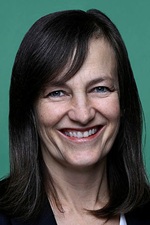
Division of Whitlam is a federal electorate in New South Wales, covering about 3,031 km². Its federal member is Carol Berry (Australian Labor Party). State electorates overlapping it include Goulburn, Wollondilly, Shellharbour, Kiama. Local council areas overlapping it include Wingecarribee Shire Council, Wollongong City Council, Shellharbour City Council.
- Level
- Federal electorate
- State / territory
- New South Wales (NSW)
- Area
- about 3,031 km²
- Federal member
- Carol Berry — Australian Labor Party
- Official source
- AEC electorate profile
On Political Gadgets
State electorates overlapping Whitlam
| Goulburn (NSW state electorate) | 63% of this federal electorate | 12% of Goulburn |
| Wollondilly (NSW state electorate) | 26% of this federal electorate | 25% of Wollondilly |
| Shellharbour (NSW state electorate) | 6% of this federal electorate | >99% of Shellharbour |
| Kiama (NSW state electorate) | 4% of this federal electorate | 6% of Kiama |
Local council areas overlapping Whitlam
| Wingecarribee Shire Council | 89% of this federal electorate | >99% of Wingecarribee Shire Council |
| Wollongong City Council | 6% of this federal electorate | 26% of Wollongong City Council |
| Shellharbour City Council | 5% of this federal electorate | >99% of Shellharbour City Council |
Suburbs in Whitlam
Suburbs with at least a quarter of their area inside this federal electorate. Select one to see all three levels of electorate.
- Albion Park 2527
- Albion Park Rail 2527
- Alpine 2575
- Avoca 2577
- Avon 2574
- Avondale 2530
- Aylmerton 2575
- Balaclava 2575
- Balmoral (Wingecarribee) 2571
- Barrack Heights 2528
- Barrack Point 2528
- Belanglo 2577
- Berrima 2577
- Blackbutt 2529
- Bowral 2576
- Braemar 2575
- Brownsville 2530
- Bullio 2575
- Bundanoon 2578/2579
- Burradoo 2576
- Burrawang 2577
- Buxton 2571
- Calderwood 2527
- Canyonleigh 2577
- Cleveland 2530
- Colo Vale 2575
- Croom 2527
- Dapto 2530
- Dombarton 2530
- Dunmore 2529
- East Kangaloon 2576
- Exeter 2579
- Fitzroy Falls 2577
- Flinders 2529
- Glenquarry 2576
- Goodmans Ford 2575
- Haywards Bay 2530
- High Range 2575
- Hill Top (Wingecarribee) 2575
- Horsley 2530
- Huntley (Wollongong) 2530
- Joadja 2575
- Kanahooka 2530
- Kangaloon 2576
- Kembla Grange 2526
- Koonawarra 2530
- Lake Illawarra 2528
- Macquarie Pass 2577
- Manchester Square 2577
- Mandemar 2575
- Marshall Mount 2530
- Medway 2577
- Meryla 2577
- Mittagong 2575
- Moss Vale 2577
- Mount Lindsey 2575
- Mount Murray 2577
- Mount Warrigal 2528
- New Berrima 2577
- Oak Flats 2529
- Paddys River (Wingecarribee) 2577
- Penrose 2579
- Renwick 2575
- Robertson 2577
- Shell Cove 2529
- Shellharbour 2529
- Shellharbour City Centre 2529
- Sutton Forest 2577
- Tongarra 2527
- Tullimbar 2527
- Upper Kangaroo Valley 2577
- Warilla 2528
- Wattle Ridge 2575
- Welby 2575
- Werai 2577
- Wildes Meadow 2577
- Willow Vale (Wingecarribee) 2575
- Wingello 2579
- Wombeyan Caves 2580
- Wongawilli 2530
- Woodlands (Wingecarribee) 2575
- Yallah 2530
- Yellow Rock (Shellharbour) 2527
- Yerrinbool 2575
Questions
Who is the federal member for Whitlam?
Carol Berry of the Australian Labor Party is the federal member for the Division of Whitlam in the House of Representatives.
Which council areas are in the Division of Whitlam?
Council areas overlapping it include Wingecarribee Shire Council, Wollongong City Council, Shellharbour City Council.
Which state electorates are in the Division of Whitlam?
State electorates overlapping it include Goulburn, Wollondilly, Shellharbour, Kiama.
Which suburbs are in Whitlam?
Suburbs mostly inside it include Albion Park, Albion Park Rail, Alpine, Avoca, Avondale, Aylmerton, Balaclava, Barrack Heights.
How accurate is this?
Boundaries are simplified (about 40 m tolerance), so overlap percentages are approximate. For anything official, such as enrolment or voting, check the Australian Electoral Commission or your state electoral commission.
← All federal electorates · Find My Electorates
Federal boundaries: Australian Electoral Commission (as at the 2025 federal election). State and council boundaries: incorporates or developed using Administrative Boundaries © Geoscape Australia licensed under CC BY 4.0.