Division of O'Connor
Division of O'Connor is a federal electorate in Western Australia, covering about 1,093,873 km². Its federal member is Rick Wilson (Liberal Party). State electorates overlapping it include Kalgoorlie, Kimberley, Roe, Central Wheatbelt. Local council areas overlapping it include Shire of Wiluna, Shire of Laverton, Shire of Ngaanyatjarraku, Shire of Menzies.
- Level
- Federal electorate
- State / territory
- Western Australia (WA)
- Area
- about 1,093,873 km²
- Federal member
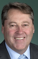
- Rick Wilson — Liberal Party
- Official source
- AEC electorate profile
On Political Gadgets
State electorates overlapping O'Connor
| Kalgoorlie (WA state electorate) | 69% of this federal electorate | >99% of Kalgoorlie |
| Kimberley (WA state electorate) | 12% of this federal electorate | 15% of Kimberley |
| Roe (WA state electorate) | 11% of this federal electorate | >99% of Roe |
| Central Wheatbelt (WA state electorate) | 4% of this federal electorate | 49% of Central Wheatbelt |
| Warren-Blackwood (WA state electorate) | 1% of this federal electorate | 88% of Warren-Blackwood |
| Albany (WA state electorate) | <1% of this federal electorate | >99% of Albany |
| Collie-Preston (WA state electorate) | <1% of this federal electorate | 78% of Collie-Preston |
Local council areas overlapping O'Connor
| Shire of Wiluna | 17% of this federal electorate | >99% of Shire of Wiluna |
| Shire of Laverton | 16% of this federal electorate | >99% of Shire of Laverton |
| Shire of Ngaanyatjarraku | 15% of this federal electorate | >99% of Shire of Ngaanyatjarraku |
| Shire of Menzies | 11% of this federal electorate | >99% of Shire of Menzies |
| City of Kalgoorlie-Boulder | 9% of this federal electorate | >99% of City of Kalgoorlie-Boulder |
| Shire of Dundas | 9% of this federal electorate | 97% of Shire of Dundas |
| Shire of Esperance | 4% of this federal electorate | 83% of Shire of Esperance |
| Shire of Leonora | 3% of this federal electorate | >99% of Shire of Leonora |
| Shire of Yilgarn | 3% of this federal electorate | >99% of Shire of Yilgarn |
| Shire of Coolgardie | 3% of this federal electorate | >99% of Shire of Coolgardie |
| Shire of Lake Grace | 1% of this federal electorate | >99% of Shire of Lake Grace |
| Shire of Ravensthorpe | <1% of this federal electorate | 90% of Shire of Ravensthorpe |
| Shire of Kondinin | <1% of this federal electorate | >99% of Shire of Kondinin |
| Shire of Manjimup | <1% of this federal electorate | 88% of Shire of Manjimup |
| Shire of Jerramungup | <1% of this federal electorate | 90% of Shire of Jerramungup |
| Shire of Kent | <1% of this federal electorate | >99% of Shire of Kent |
| Shire of Plantagenet | <1% of this federal electorate | >99% of Shire of Plantagenet |
| Shire of Kulin | <1% of this federal electorate | >99% of Shire of Kulin |
| City of Albany | <1% of this federal electorate | 72% of City of Albany |
| Shire of Gnowangerup | <1% of this federal electorate | >99% of Shire of Gnowangerup |
| Shire of Narembeen | <1% of this federal electorate | >99% of Shire of Narembeen |
| Shire of Cranbrook | <1% of this federal electorate | >99% of Shire of Cranbrook |
| Shire of Nannup | <1% of this federal electorate | 93% of Shire of Nannup |
| Shire of Kojonup | <1% of this federal electorate | >99% of Shire of Kojonup |
| Shire of West Arthur | <1% of this federal electorate | >99% of Shire of West Arthur |
| Shire of Boyup Brook | <1% of this federal electorate | >99% of Shire of Boyup Brook |
| Shire of Bruce Rock | <1% of this federal electorate | >99% of Shire of Bruce Rock |
| Shire of Corrigin | <1% of this federal electorate | >99% of Shire of Corrigin |
| Shire of Broomehill-Tambellup | <1% of this federal electorate | >99% of Shire of Broomehill-Tambellup |
| Shire of Dumbleyung | <1% of this federal electorate | >99% of Shire of Dumbleyung |
Suburbs in O'Connor
Suburbs with at least a quarter of their area inside this federal electorate. Select one to see all three levels of electorate.
- Adamsvale 6375
- Albany 6330
- Allanson 6225
- Amelup 6338
- Ardath 6419
- Arthur River 6315
- Babakin 6428
- Badgebup 6317
- Badjaling 6383
- Balbarrup 6258
- Balingup 6253
- Balladonia 6443
- Ballaying 6315
- Bandya 6440
- Bannister 6390
- Barrabup 6275
- Bayonet Head 6330
- Beadell 6440
- Beaufort River 6394
- Beaumont 6450
- Beedelup 6260
- Beenong 6353
- Benjinup 6255
- Biddelia 6260
- Big Grove 6330
- Bilbarin 6375
- Binduli 6430
- Bobalong 6320
- Bodallin 6424
- Boddington 6390
- Boilup 6394
- Bokal 6392
- Boorabbin 6429
- Boorara 6431
- Boorara Brook 6262
- Borden 6338
- Borderdale 6320
- Boscabel 6394
- Boulder 6432
- Boundain 6312
- Bowelling 6225
- Boyatup 6450
- Boyerine 6316
- Boyup Brook 6244
- Brazier 6251
- Bridgetown 6255
- Broadwood 6430
- Brookhampton 6239
- Broomehill East 6318
- Broomehill Village 6318
- Broomehill West 6318
- Brown Hill 6431
- Buckingham 6225
- Bullabulling 6429
- Bullaring 6373
- Bullfinch 6484
- Bullock Hills 6317
- Bulong 6431
- Bulyee 6306
- Buniche 6353
- Buraminya 6452
- Caiguna 6443
- Cancanning 6315
- Cardiff 6225
- Carlotta 6275
- Carrolup 6317
- Cartmeticup 6316
- Cascade 6450
- Catterick 6255
- Centennial Park 6330
- Changerup 6394
- Channybearup 6260
- Charley Creek 6239
- Cherry Tree Pool 6395
- Chowerup 6244
- Coblinine 6317
- Cocklebiddy 6443
- Codjatotine 6308
- Collanilling 6315
- Collie 6225
- Collie Burn 6225
- Collingwood Heights 6330
- Collins 6260
- Commodine 6311
- Contine 6311
- Coolgardie 6429
- Corinthia 6426
- Corrigin 6375
- Cosmo Newbery 6440
- Cowalellup 6336
- Coyrecup 6317
- Cranbrook 6321
- Crossman 6390
- Crowea 6262
- Cuballing 6311
- Cundeelee 6434
- Cuthbert 6330
- Dangin 6383
- Dardadine 6392
- Darkan 6392
- Dartnall 6320
- Datatine 6317
- Deanmill 6258
- Denbarker 6324
- Denmark 6333
- Diamond Tree 6258
- Dingup 6258
- Dinninup 6244
- Dixvale 6258
- Dongolocking 6315
- Donnelly River 6258
- Drome 6330
- Dryandra 6311
- Dudinin 6363
- Dulyalbin 6425
- Dumberning 6312
- Dumbleyung 6350
- Dundas 6443
- Dunn Rock 6355
- Duranillin 6393
- Dwarda 6308
- East Nannup 6275
- East Newdegate 6355
- East Pingelly 6308
- East Popanyinning 6309
- East Wickepin 6370
- Eastbrook 6260
- Emu Flat 6431
- Ennuin 6484
- Eucla 6443
- Ewlyamartup 6317
- Feysville 6431
- Fimiston 6432
- Fitzgerald 6337
- Forest Hill 6324
- Forrest 6434
- Forrestania 6359
- Frankland River 6396
- Fraser Range 6443
- Gairdner 6337
- Ghooli 6426
- Gibson 6448
- Gibson Desert South 0872
- Gillimanning 6370
- Gledhow 6330
- Glen Mervyn 6239
- Glencoe 6316
- Glenlynn 6256
- Glenoran 6258
- Gnowangerup 6335
- Gnowellen 6328
- Gorge Rock 6375
- Grass Patch 6446
- Green Valley 6330
- Greenbushes 6254
- Grimwade 6253
- Gundaring 6315
- Hannans 6430
- Harrismith 6361
- Hastings 6308
- Hatter Hill 6356
- Hay 6333
- Hazelvale 6333
- Hester 6255
- Hester Brook 6255
- Higginsville 6443
- Highbury 6313
- Hillside 6312
- Holleton 6426
- Holt Rock 6355
- Hyden 6359
- Irrunytju 0872
- Jackitup 6335
- Jacup 6337
- Jalbarragup 6275
- Jaloran 6315
- Jardee 6258
- Jerramungup 6337
- Jilakin 6365
- Jingalup 6395
- Jitarning 6365
- Kalgoorlie 6430
- Kambalda East 6442
- Kambalda West 6442
- Kangaroo Gully 6255
- Kanowna 6431
- Kanpa 0872
- Karlgarin 6358
- Karlkurla 6430
- Karramindie 6429
- Katanning 6317
- Kebaringup 6335
- Kendenup 6323
- Kenmare 6316
- Kentdale 6333
- King River 6330
- Kingston 6256
- Kirk Rock 6372
- Kirup 6251
- Kojaneerup South 6328
- Kojonup 6395
- Kondinin 6367
- Kookynie 6431
- Koolyanobbing 6427
- Kordabup 6333
- Kuender 6353
- Kukerin 6352
- Kulikup 6244
- Kulin 6365
- Kulin West 6365
- Kunjin 6375
- Kurnalpi 6431
- Kurrenkutten 6375
- Kweda 6306
- Kwolyin 6385
- Lake Biddy 6355
- Lake Camm 6355
- Lake Carnegie 6646
- Lake Darlot 6438
- Lake Deborah 6484
- Lake Grace 6353
- Lake King 6356
- Lake Muir 6258
- Lake Toolbrunup 6320
- Lake Wells 6440
- Lamington 6430
- Lange 6330
- Laverton 6440
- Leinster 6437
- Leonora 6438
- Lime Lake 6315
- Linfarne 6258
- Little Grove 6330
- Little Italy 6359
- Lockyer 6330
- Lol Gray 6311
- Londonderry 6429
- Lort River 6447
- Lower Hotham 6390
- Lower King 6330
- Lumeah 6395
- Lyalls Mill 6225
- Magenta 6355
- Magitup 6338
- Mallee Hill 6353
- Malyalling 6370
- Manjimup 6258
- Mantamaru 0872
- Maranup 6256
- Marbelup 6330
Showing 250 of 564 suburbs.
Questions
Who is the federal member for O'Connor?
Rick Wilson of the Liberal Party is the federal member for the Division of O'Connor in the House of Representatives.
Which council areas are in the Division of O'Connor?
Council areas overlapping it include Shire of Wiluna, Shire of Laverton, Shire of Ngaanyatjarraku, Shire of Menzies, City of Kalgoorlie-Boulder, Shire of Dundas.
Which state electorates are in the Division of O'Connor?
State electorates overlapping it include Kalgoorlie, Kimberley, Roe, Central Wheatbelt, Warren-Blackwood, Albany.
Which suburbs are in O'Connor?
Suburbs mostly inside it include Adamsvale, Albany, Allanson, Amelup, Ardath, Arthur River, Babakin, Badgebup.
How accurate is this?
Boundaries are simplified (about 40 m tolerance), so overlap percentages are approximate. For anything official, such as enrolment or voting, check the Australian Electoral Commission or your state electoral commission.
← All federal electorates · Find My Electorates
Federal boundaries: Australian Electoral Commission (as at the 2025 federal election). State and council boundaries: incorporates or developed using Administrative Boundaries © Geoscape Australia licensed under CC BY 4.0.