Division of Monash
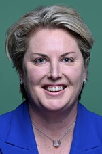
Division of Monash is a federal electorate in Victoria, covering about 8,268 km². Its federal member is Mary Aldred (Liberal Party). State electorates overlapping it include Narracan, Gippsland South, Bass. Local council areas overlapping it include Baw Baw Shire, South Gippsland Shire, Bass Coast Shire, Mount Baw Baw Alpine Resort (Unincorporated).
- Level
- Federal electorate
- State / territory
- Victoria (VIC)
- Area
- about 8,268 km²
- Federal member
- Mary Aldred — Liberal Party
- Role
- Opposition Whip
- Official source
- AEC electorate profile
On Political Gadgets
State electorates overlapping Monash
| Narracan (VIC state electorate) | 48% of this federal electorate | 89% of Narracan |
| Gippsland South (VIC state electorate) | 40% of this federal electorate | 40% of Gippsland South |
| Bass (VIC state electorate) | 10% of this federal electorate | 63% of Bass |
Local council areas overlapping Monash
| Baw Baw Shire | 48% of this federal electorate | >99% of Baw Baw Shire |
| South Gippsland Shire | 40% of this federal electorate | >99% of South Gippsland Shire |
| Bass Coast Shire | 10% of this federal electorate | >99% of Bass Coast Shire |
| Mount Baw Baw Alpine Resort (Unincorporated) | <1% of this federal electorate | >99% of Mount Baw Baw Alpine Resort (Unincorporated) |
Suburbs in Monash
Suburbs with at least a quarter of their area inside this federal electorate. Select one to see all three levels of electorate.
- Aberfeldy 3825
- Ada 3833
- Adams Estate 3984
- Agnes 3962
- Allambee 3823
- Allambee Reserve 3871
- Allambee South 3871
- Almurta 3979
- Amor 3825
- Anderson 3995
- Arawata 3951
- Archies Creek 3995
- Athlone 3818
- Baromi 3871
- Bass 3991
- Baw Baw 3833
- Baw Baw Village 3833
- Bena 3946
- Bennison 3960
- Berrys Creek 3953
- Bona Vista 3820
- Boola 3825
- Boolarong 3960
- Boorool 3953
- Brandy Creek 3821
- Bravington 3821
- Buffalo 3958
- Buln Buln 3821
- Buln Buln East 3821
- Cape Paterson 3995
- Cape Woolamai 3925
- Caringal 3825
- Childers 3824
- Churchill Island 3925
- Cloverlea 3822
- Coalville 3825
- Corinella 3984
- Coronet Bay 3984
- Cowes 3922
- Crossover 3821
- Dalyston 3992
- Darlimurla 3871
- Darnum 3822
- Delburn 3871
- Dollar 3871
- Drouin 3818
- Drouin East 3818
- Drouin South 3818
- Drouin West 3818
- Dumbalk 3956
- Dumbalk North 3956
- Ellinbank 3821
- Erica 3825
- Fairbank 3951
- Ferndale 3821
- Fish Creek 3959
- Foster 3960
- Foster North 3960
- Fumina 3825
- Fumina South 3825
- Gainsborough 3822
- Gentle Annie 3833
- Glen Alvie 3979
- Glen Forbes 3990
- Grantville 3984
- Gunyah 3960
- Hallora 3818
- Hallston 3953
- Harmers Haven 3995
- Hazel Park 3966
- Heath Hill 3981
- Hedley 3967
- Hernes Oak 3825
- Hill End 3825
- Icy Creek 3833
- Inverloch 3996
- Jacob Creek 3825
- Jam Jerrup 3984
- Jeetho 3945
- Jericho 3825
- Jindivick 3818
- Jumbunna 3951
- Kardella 3951
- Kardella South 3950
- Kernot 3979
- Kilcunda 3995
- Kongwak 3951
- Koonwarra 3954
- Koorooman 3953
- Korumburra 3950
- Korumburra South 3950
- Krowera 3945
- Labertouche 3816
- Lance Creek 3995
- Lang Lang 3984
- Lardner 3821
- Leongatha 3953
- Leongatha North 3953
- Leongatha South 3953
- Lillico 3820
- Loch 3945
- Loch Valley 3833
- Longwarry 3816
- Longwarry North 3816
- Mardan 3953
- Meeniyan 3956
- Middle Tarwin 3956
- Mirboo 3871
- Mirboo North 3871
- Modella 3816
- Moe 3825
- Moe South 3825
- Moondarra 3825
- Mount Best 3960
- Mount Eccles 3953
- Mountain View 3988
- Narracan 3824
- Nayook 3832
- Neerim 3831
- Neerim East 3831
- Neerim Junction 3832
- Neerim North 3832
- Neerim South 3831
- Nerrena 3953
- Newborough 3825
- Newhaven 3925
- Nilma 3821
- Nilma North 3821
- Noojee 3833
- North Wonthaggi 3995
- Nyora 3987
- Outtrim 3951
- Piedmont 3833
- Pioneer Bay 3984
- Poowong 3988
- Poowong East 3988
- Poowong North 3988
- Port Franklin 3964
- Port Welshpool 3965
- Pound Creek 3996
- Ranceby 3951
- Rawson 3825
- Rhyll 3923
- Ripplebrook 3818
- Rokeby 3821
- Ruby 3953
- Ryanston 3992
- San Remo 3925
- Sandy Point 3959
- Seaview 3821
- Shady Creek 3821
- Silverleaves 3922
- Smiths Beach 3922
- South Dudley 3995
- St Clair 3995
- Stony Creek (South Gippsland - Vic.) 3957
- Strzelecki 3950
- Summerlands 3922
- Sunderland Bay 3922
- Sunset Strip 3922
- Surf Beach 3922
- Tanjil 3825
- Tanjil Bren 3833
- Tanjil South 3825
- Tarwin 3956
- Tarwin Lower 3956
- Tenby Point 3984
- Tetoora Road 3821
- The Gurdies 3984
- Thomson (Baw Baw - Vic.) 3825
- Thorpdale 3835
- Thorpdale South 3824
- Toombon 3825
- Toongabbie 3856
- Toora 3962
- Toora North 3962
- Toorongo 3833
- Torwood 3821
- Trafalgar 3824
- Trafalgar East 3824
- Trafalgar South 3824
- Trida 3953
- Turtons Creek 3960
- Ventnor 3922
- Venus Bay 3956
- Vesper 3833
- Walhalla 3825
- Walkerville 3956
- Walkerville North 3956
- Walkerville South 3956
- Waratah Bay 3959
- Warragul 3820
- Warragul South 3821
- Warragul West 3821
- Wattle Bank 3995
- Welshpool 3966
- West Creek 3992
- Westbury 3825
- Whitelaw 3950
- Wild Dog Valley 3953
- Willow Grove 3825
- Wilsons Promontory 3960
- Wimbledon Heights 3922
- Wonga 3960
- Wonthaggi 3995
- Woodleigh 3945
- Woolamai 3995
- Woorarra East 3962
- Woorarra West 3960
- Wooreen 3953
- Yallourn 3825
- Yanakie 3960
- Yarragon 3823
- Yarragon South 3823
Questions
Who is the federal member for Monash?
Mary Aldred of the Liberal Party is the federal member for the Division of Monash in the House of Representatives.
Which council areas are in the Division of Monash?
Council areas overlapping it include Baw Baw Shire, South Gippsland Shire, Bass Coast Shire, Mount Baw Baw Alpine Resort (Unincorporated).
Which state electorates are in the Division of Monash?
State electorates overlapping it include Narracan, Gippsland South, Bass.
Which suburbs are in Monash?
Suburbs mostly inside it include Aberfeldy, Adams Estate, Allambee, Allambee Reserve, Allambee South, Almurta, Amor, Anderson.
How accurate is this?
Boundaries are simplified (about 40 m tolerance), so overlap percentages are approximate. For anything official, such as enrolment or voting, check the Australian Electoral Commission or your state electoral commission.
← All federal electorates · Find My Electorates
Federal boundaries: Australian Electoral Commission (as at the 2025 federal election). State and council boundaries: incorporates or developed using Administrative Boundaries © Geoscape Australia licensed under CC BY 4.0.