Division of Mayo
Division of Mayo is a federal electorate in South Australia, covering about 9,135 km². Its federal member is Rebekha Sharkie (Centre Alliance). State electorates overlapping it include Mawson, Finniss, Heysen, Hammond. Local council areas overlapping it include Kangaroo Island Council, Alexandrina Council, Adelaide Hills Council, The DC of Yankalilla.
- Level
- Federal electorate
- State / territory
- South Australia (SA)
- Area
- about 9,135 km²
- Federal member
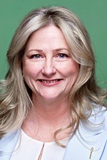
- Rebekha Sharkie — Centre Alliance
- Official source
- AEC electorate profile
On Political Gadgets
State electorates overlapping Mayo
| Mawson (SA state electorate) | 58% of this federal electorate | >99% of Mawson |
| Finniss (SA state electorate) | 15% of this federal electorate | >99% of Finniss |
| Heysen (SA state electorate) | 10% of this federal electorate | >99% of Heysen |
| Hammond (SA state electorate) | 8% of this federal electorate | 23% of Hammond |
| Schubert (SA state electorate) | 4% of this federal electorate | 17% of Schubert |
| Kavel (SA state electorate) | 3% of this federal electorate | >99% of Kavel |
| Bragg (SA state electorate) | <1% of this federal electorate | 46% of Bragg |
| Waite (SA state electorate) | <1% of this federal electorate | 29% of Waite |
| Morialta (SA state electorate) | <1% of this federal electorate | 37% of Morialta |
Local council areas overlapping Mayo
| Kangaroo Island Council | 48% of this federal electorate | >99% of Kangaroo Island Council |
| Alexandrina Council | 20% of this federal electorate | >99% of Alexandrina Council |
| Adelaide Hills Council | 9% of this federal electorate | >99% of Adelaide Hills Council |
| The DC of Yankalilla | 8% of this federal electorate | >99% of The DC of Yankalilla |
| Mount Barker District Council | 7% of this federal electorate | >99% of Mount Barker District Council |
| City of Victor Harbor | 4% of this federal electorate | >99% of City of Victor Harbor |
| City of Onkaparinga | 4% of this federal electorate | 71% of City of Onkaparinga |
Suburbs in Mayo
Suburbs with at least a quarter of their area inside this federal electorate. Select one to see all three levels of electorate.
- Aldgate 5154
- Aldinga 5173
- Aldinga Beach 5173
- American Beach 5222
- American River 5221
- Angas Plains 5255
- Antechamber Bay 5222
- Ashbourne 5157
- Ashton 5137
- Back Valley 5211
- Bald Hills 5203
- Balhannah 5242
- Ballast Head 5221
- Basket Range 5138
- Baudin Beach 5222
- Bay Of Shoals 5223
- Belvidere 5255
- Biggs Flat 5153
- Birchmore 5223
- Birdwood 5234
- Blackfellows Creek 5201
- Blakiston 5250
- Bletchley 5255
- Blewitt Springs 5171
- Bradbury 5153
- Bridgewater 5155
- Brown Beach 5222
- Brownlow Ki 5223
- Brukunga 5252
- Bugle Ranges 5251
- Bull Creek 5157
- Callington 5254
- Cape Borda 5223
- Cape Jervis 5204
- Carey Gully 5144
- Carrickalinga 5204
- Cassini 5223
- Castambul 5076
- Chain Of Ponds 5231
- Chandlers Hill 5159
- Chapel Hill 5153
- Charleston 5244
- Cherry Gardens 5157
- Cherryville 5134
- Chiton 5211
- Clarendon 5157
- Clayton Bay 5256
- Cleland 5152
- Coromandel East 5157
- Coromandel Valley 5051
- Crafers 5152
- Crafers West 5152
- Craigburn Farm 5051
- Cromer 5235
- Cudlee Creek 5232
- Currency Creek 5214
- Cuttlefish Bay 5222
- Cygnet River 5223
- D'Estrees Bay 5223
- Dawesley 5252
- De Mole River 5223
- Deep Creek 5204
- Delamere 5204
- Dingabledinga 5172
- Dorset Vale 5153
- Dudley East 5222
- Dudley West 5222
- Duncan 5223
- Echunga 5153
- Emu Bay 5223
- Encounter Bay 5211
- Finniss 5255
- Flaxley 5153
- Flinders Chase 5223
- Forest Range 5139
- Forreston 5233
- Gemmells 5255
- Goolwa 5214
- Goolwa Beach 5214
- Goolwa North 5214
- Goolwa South 5214
- Gosse 5223
- Green Hills Range 5153
- Greenhill 5140
- Gumeracha 5233
- Hahndorf 5245
- Haines 5223
- Harrogate 5244
- Hartley 5255
- Hawthorndene 5051
- Hay Flat 5204
- Hay Valley 5252
- Hayborough 5211
- Heathfield 5153
- Highland Valley 5255
- Hindmarsh Island 5214
- Hindmarsh Tiers 5202
- Hindmarsh Valley 5211
- Hope Forest 5172
- Horsnell Gully 5141
- Houghton 5131
- Humbug Scrub 5114
- Inglewood 5133
- Inman Valley 5211
- Ironbank 5153
- Ironstone 5222
- Island Beach 5222
- Jupiter Creek 5153
- Kangarilla 5157
- Kangaroo Head 5222
- Kanmantoo 5252
- Karatta 5223
- Kenton Valley 5233
- Kersbrook 5231
- Kingscote 5223
- Kohinoor 5223
- Kuitpo 5201
- Kuitpo Colony 5172
- Kyeema 5172
- Lake Alexandrina 5259
- Lake Plains 5255
- Langhorne Creek 5255
- Lenswood 5240
- Littlehampton 5250
- Lobethal 5241
- Longwood 5153
- Lower Hermitage 5131
- Lower Inman Valley 5211
- Macclesfield 5153
- Macgillivray 5223
- Marble Hill 5137
- McCracken 5211
- McHarg Creek 5157
- McLaren Flat 5171
- McLaren Vale 5171
- Meadows 5201
- Menzies 5223
- Middle River 5223
- Middleton 5213
- Milang 5256
- Millbrook 5231
- Montacute 5134
- Montarra 5172
- Mosquito Hill 5214
- Mount Barker 5251
- Mount Barker Junction 5251
- Mount Barker Springs 5251
- Mount Barker Summit 5251
- Mount Compass 5210
- Mount George 5155
- Mount Jagged 5211
- Mount Magnificent 5210
- Mount Observation 5255
- Mount Torrens 5244
- Mundoo Island 5214
- Muston 5221
- Mylor 5153
- Myponga 5202
- Myponga Beach 5202
- Nairne 5252
- Nangkita 5210
- Nepean Bay 5223
- Newland 5223
- Normanville 5204
- North Cape 5223
- Norton Summit 5136
- Nurragi 5256
- Oakbank 5243
- Old Noarlunga 5168
- Paechtown 5245
- Pages Flat 5172
- Paracombe 5132
- Parawa 5203
- Paris Creek 5201
- Parndana 5220
- Pelican Lagoon 5222
- Penneshaw 5222
- Petwood 5254
- Piccadilly 5151
- Point Sturt 5256
- Porky Flat 5222
- Port Elliot 5212
- Port Willunga 5173
- Prospect Hill 5201
- Rapid Bay 5204
- Red Creek 5255
- Sandergrove 5255
- Sapphiretown 5222
- Scott Creek 5153
- Seal Bay 5223
- Second Valley 5204
- Seddon 5223
- Sellicks Beach 5174
- Sellicks Hill 5174
- Silverton 5204
- St Ives 5252
- Stirling 5152
- Stokes Bay 5223
- Strathalbyn 5255
- Stun'Sail Boom 5223
- Summertown 5141
- Tatachilla 5171
- Teringie 5072
- The Range 5172
- Tolderol 5256
- Tooperang 5255
- Torrens Vale 5203
- Totness 5250
- Tunkalilla 5203
- Upper Hermitage 5131
- Upper Sturt 5156
- Uraidla 5142
- Verdun 5245
- Victor Harbor 5211
- Vivonne Bay 5223
- Waitpinga 5211
- Wattle Flat 5203
- Western River 5223
- Whites Valley 5172
- Willoughby 5222
- Willow Creek 5211
- Willson River 5222
- Willunga 5172
- Willunga Hill 5172
- Willunga South 5172
- Willyaroo 5255
- Wirrina Cove 5204
- Wisanger 5223
- Wistow 5251
- Woodchester 5255
- Woodforde 5072
- Woodside 5244
- Yankalilla 5203
- Yundi 5172
Questions
Who is the federal member for Mayo?
Rebekha Sharkie of the Centre Alliance is the federal member for the Division of Mayo in the House of Representatives.
Which council areas are in the Division of Mayo?
Council areas overlapping it include Kangaroo Island Council, Alexandrina Council, Adelaide Hills Council, The DC of Yankalilla, Mount Barker District Council, City of Victor Harbor.
Which state electorates are in the Division of Mayo?
State electorates overlapping it include Mawson, Finniss, Heysen, Hammond, Schubert, Kavel.
Which suburbs are in Mayo?
Suburbs mostly inside it include Aldgate, Angas Plains, Ashbourne, Ashton, Back Valley, Bald Hills, Balhannah, Basket Range.
How accurate is this?
Boundaries are simplified (about 40 m tolerance), so overlap percentages are approximate. For anything official, such as enrolment or voting, check the Australian Electoral Commission or your state electoral commission.
← All federal electorates · Find My Electorates
Federal boundaries: Australian Electoral Commission (as at the 2025 federal election). State and council boundaries: incorporates or developed using Administrative Boundaries © Geoscape Australia licensed under CC BY 4.0.