Division of Maranoa
Division of Maranoa is a federal electorate in Queensland, covering about 730,423 km². Its federal member is David Littleproud (Liberal National Party). State electorates overlapping it include Warrego, Gregory, Southern Downs, Callide. Local council areas overlapping it include Diamantina Shire, Bulloo Shire, Quilpie Shire, Barcoo Shire.
- Level
- Federal electorate
- State / territory
- Queensland (QLD)
- Area
- about 730,423 km²
- Federal member
- David Littleproud — Liberal National Party
- Official source
- AEC electorate profile
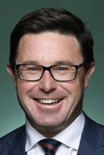
On Political Gadgets
State electorates overlapping Maranoa
| Warrego (QLD state electorate) | 46% of this federal electorate | >99% of Warrego |
| Gregory (QLD state electorate) | 46% of this federal electorate | 73% of Gregory |
| Southern Downs (QLD state electorate) | 4% of this federal electorate | >99% of Southern Downs |
| Callide (QLD state electorate) | 3% of this federal electorate | 26% of Callide |
| Nanango (QLD state electorate) | <1% of this federal electorate | 31% of Nanango |
| Condamine (QLD state electorate) | <1% of this federal electorate | 21% of Condamine |
Local council areas overlapping Maranoa
| Diamantina Shire | 13% of this federal electorate | >99% of Diamantina Shire |
| Bulloo Shire | 10% of this federal electorate | >99% of Bulloo Shire |
| Quilpie Shire | 9% of this federal electorate | >99% of Quilpie Shire |
| Barcoo Shire | 9% of this federal electorate | >99% of Barcoo Shire |
| Maranoa Regional | 8% of this federal electorate | >99% of Maranoa Regional |
| Winton Shire | 7% of this federal electorate | >99% of Winton Shire |
| Barcaldine Regional | 7% of this federal electorate | 99% of Barcaldine Regional |
| Paroo Shire | 7% of this federal electorate | >99% of Paroo Shire |
| Murweh Shire | 6% of this federal electorate | >99% of Murweh Shire |
| Longreach Regional | 6% of this federal electorate | >99% of Longreach Regional |
| Western Downs Regional | 5% of this federal electorate | >99% of Western Downs Regional |
| Balonne Shire | 4% of this federal electorate | >99% of Balonne Shire |
| Blackall Tambo Regional | 4% of this federal electorate | >99% of Blackall Tambo Regional |
| Goondiwindi Regional | 3% of this federal electorate | >99% of Goondiwindi Regional |
| Toowoomba Regional | 1% of this federal electorate | 57% of Toowoomba Regional |
| Southern Downs Regional | <1% of this federal electorate | >99% of Southern Downs Regional |
| South Burnett Regional | <1% of this federal electorate | 49% of South Burnett Regional |
Suburbs in Maranoa
Suburbs with at least a quarter of their area inside this federal electorate. Select one to see all three levels of electorate.
- Adavale 4474
- Alice Creek 4610
- Allan 4370
- Allora 4362
- Amby 4462
- Amiens 4380
- Auburn 4413
- Augathella 4477
- Back Plains 4361
- Baffle West 4454
- Bakers Bend 4470
- Baking Board 4413
- Ballaroo 4455
- Bapaume 4352
- Barakula 4413
- Barcaldine 4725
- Bargunyah 4488
- Barker Creek Flat 4615
- Barramornie 4416
- Barringun 4490
- Bayrick 4478
- Bedourie 4829
- Beelbee 4406
- Begonia 4487
- Bell 4408
- Benair 4610
- Benarkin 4314
- Benarkin North 4314
- Berat 4362
- Billa Billa 4390
- Bindebango 4488
- Birdsville 4482
- Blackall 4472
- Blackbutt 4314
- Blackbutt North 4314
- Blackbutt South 4314
- Blackswamp 4413
- Blythdale 4455
- Boatman 4468
- Bogandilla 4425
- Bollon 4488
- Bony Mountain 4370
- Booie 4610
- Boonarga 4413
- Boondandilla 4406
- Boyneside 4610
- Brigalow 4412
- Bringalily 4357
- Broadwater 4380
- Brooklands 4615
- Brush Creek 4387
- Bulli Creek 4357
- Bulloo Downs 4492
- Bundi 4419
- Bungeworgorai 4455
- Bungil 4455
- Bunya Mountains 4405
- Burncluith 4413
- Bybera 4387
- Bymount 4455
- Calingunee 4390
- Cameby 4413
- Cameron Corner 4492
- Canaga 4413
- Canning Creek 4357
- Canningvale 4370
- Cannon Creek (Southern Downs - Qld) 4380
- Captains Mountain 4357
- Caroline Crossing 4477
- Cattle Creek (Toowoomba - Qld) 4407
- Cement Mills 4352
- Chances Plain 4413
- Charleville 4470
- Chinchilla 4413
- Clara Creek 4468
- Clifford 4427
- Clifton 4361
- Clintonvale 4370
- Clontarf (Toowoomba - Qld) 4357
- Columboola 4415
- Condamine 4416
- Condamine Farms 4357
- Coolabunia 4610
- Cooladdi 4479
- Coolmunda 4387
- Coomrith 4422
- Coongoola 4490
- Cooranga 4408
- Cooyar 4402
- Corfield 4733
- Cornwall 4455
- Crawford 4610
- Crossroads 4413
- Crows Nest 4355
- Cunnamulla 4490
- Cunningham 4370
- Cuttaburra 4490
- Cypress Gardens 4357
- Dalby 4405
- Dalwogon 4415
- Danderoo 4370
- Dargal Road 4455
- Daymar 4497
- Deuchar 4362
- Diamantina Lakes 4735
- Diamondvale 4380
- Diamondy 4410
- Dirranbandi 4486
- Domville 4357
- Drillham 4424
- Drillham South 4424
- Ducklo 4405
- Dulacca 4425
- Dunkeld 4465
- Dunmore 4407
- Durham 4492
- Durham Downs 4454
- East Cooyar 4353
- Ellesmere 4610
- Ellinthorp 4362
- Elphinstone (Toowoomba - Qld) 4361
- Emu Creek 4355
- Eromanga 4480
- Eulo 4491
- Eumamurrin 4455
- Eurella 4462
- Euthulla 4455
- Fairyland 4413
- Farrars Creek 4481
- Fletcher 4381
- Fleurbaix 4375
- Flinton 4422
- Forest Ridge 4357
- Forest Springs 4362
- Forestvale 4465
- Freestone 4370
- Gilla 4314
- Gladfield 4370
- Glan Devon 4615
- Glen Aplin 4381
- Glenaubyn 4424
- Glenaven 4355
- Glengallan 4370
- Glenlyon 4380
- Glenmorgan 4423
- Goldfields 4380
- Goodar 4390
- Goodger 4610
- Googa Creek 4314
- Goombi 4413
- Goranba 4421
- Gore 4352
- Gowrie Station 4470
- Grays Gate 4357
- Greenlands 4380
- Greenswamp 4413
- Greenup 4387
- Greymare 4370
- Guluguba 4418
- Gunnewin 4455
- Gurulmundi 4415
- Halliford 4406
- Haly Creek 4610
- Hannaford 4406
- Headington Hill 4361
- Hebel 4486
- Hendon 4362
- Highland Plains (Maranoa - Qld) 4454
- Hodgleigh 4610
- Hodgson 4455
- Hookswood 4415
- Hopeland 4413
- Humeburn 4490
- Hungerford 4493
- Hutton Creek 4454
- Ilfracombe 4727
- Inglestone 4422
- Inglewood 4387
- Injune 4454
- Inverlaw 4610
- Ironpot (South Burnett - Qld) 4610
- Isisford 4731
- Jackson 4426
- Jackson North 4426
- Jackson South 4426
- Jandowae 4410
- Jericho 4728
- Jimbour East 4406
- Jimbour West 4406
- Jinghi 4410
- Jobs Gate 4490
- Jones Gully 4355
- Junabee 4370
- Jundah 4736
- Kaimkillenbun 4406
- Karara 4352
- Kilmorey Falls 4465
- Kindon 4390
- Kingaroy 4610
- Kings Creek 4361
- Kioma 4498
- Kogan 4406
- Kooralgin 4402
- Kooroongarra 4357
- Kowguran 4415
- Kumbarilla 4405
- Kumbia 4610
- Kunioon 4615
- Kurrowah 4352
- Kyoomba 4380
- Langlands 4413
- Langlo 4470
- Lansdowne 4478
- Lavelle 4357
- Lemontree 4357
- Leslie 4370
- Leslie Dam 4370
- Leyburn 4365
- Limevale 4384
- Linden 4490
- Loch Lomond 4370
- Longreach 4730
- Lumeah 4478
- Lundavra 4390
- Lyra 4382
- Macalister 4406
- Macfarlane 4478
- Maidenwell 4615
- Mannuem 4610
- Marmadua 4405
- Maryvale (Southern Downs - Qld) 4370
- Massie 4370
- Meandarra 4422
- Memerambi 4610
- Miles 4415
- Millmerran 4357
- Millmerran Downs 4357
- Millmerran Woods 4357
- Millwood 4357
- Minnie Downs 4478
- Missen Flat 4361
- Mitchell 4465
- Montrose (Southern Downs - Qld) 4370
- Montrose (Western Downs - Qld) 4413
- Mooga 4455
- Moonie 4406
- Moraby 4416
- Morgan Park 4370
- Morven 4468
- Mosquito Creek 4387
Showing 250 of 535 suburbs.
Questions
Who is the federal member for Maranoa?
David Littleproud of the Liberal National Party is the federal member for the Division of Maranoa in the House of Representatives.
Which council areas are in the Division of Maranoa?
Council areas overlapping it include Diamantina Shire, Bulloo Shire, Quilpie Shire, Barcoo Shire, Maranoa Regional, Winton Shire.
Which state electorates are in the Division of Maranoa?
State electorates overlapping it include Warrego, Gregory, Southern Downs, Callide, Nanango, Condamine.
Which suburbs are in Maranoa?
Suburbs mostly inside it include Adavale, Alice Creek, Allan, Allora, Amby, Amiens, Auburn, Augathella.
How accurate is this?
Boundaries are simplified (about 40 m tolerance), so overlap percentages are approximate. For anything official, such as enrolment or voting, check the Australian Electoral Commission or your state electoral commission.
← All federal electorates · Find My Electorates
Federal boundaries: Australian Electoral Commission (as at the 2025 federal election). State and council boundaries: incorporates or developed using Administrative Boundaries © Geoscape Australia licensed under CC BY 4.0.