Division of Leichhardt
Division of Leichhardt is a federal electorate in Queensland, covering about 300,967 km². Its federal member is Matt Smith (Australian Labor Party). State electorates overlapping it include Cook, Barron River, Mulgrave, Cairns. Local council areas overlapping it include Cook Shire, Torres Shire, Carpentaria Shire, Mareeba Shire.
- Level
- Federal electorate
- State / territory
- Queensland (QLD)
- Area
- about 300,967 km²
- Federal member
- Matt Smith — Australian Labor Party
- Official source
- AEC electorate profile
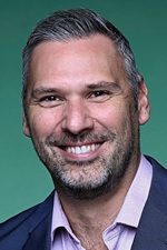
On Political Gadgets
State electorates overlapping Leichhardt
| Cook (QLD state electorate) | 98% of this federal electorate | 85% of Cook |
| Barron River (QLD state electorate) | <1% of this federal electorate | 98% of Barron River |
| Mulgrave (QLD state electorate) | <1% of this federal electorate | 21% of Mulgrave |
| Cairns (QLD state electorate) | <1% of this federal electorate | >99% of Cairns |
Local council areas overlapping Leichhardt
| Cook Shire | 61% of this federal electorate | >99% of Cook Shire |
| Torres Shire | 16% of this federal electorate | >99% of Torres Shire |
| Carpentaria Shire | 3% of this federal electorate | 13% of Carpentaria Shire |
| Mareeba Shire | 3% of this federal electorate | 15% of Mareeba Shire |
| Aurukun Shire | 2% of this federal electorate | >99% of Aurukun Shire |
| Douglas Shire | 2% of this federal electorate | >99% of Douglas Shire |
| Pormpuraaw Aboriginal Shire | 1% of this federal electorate | >99% of Pormpuraaw Aboriginal Shire |
| Lockhart River Aboriginal Shire | 1% of this federal electorate | >99% of Lockhart River Aboriginal Shire |
| Kowanyama Aboriginal Shire | <1% of this federal electorate | >99% of Kowanyama Aboriginal Shire |
| Napranum Aboriginal Shire | <1% of this federal electorate | >99% of Napranum Aboriginal Shire |
| Cairns Regional | <1% of this federal electorate | 24% of Cairns Regional |
| Hope Vale Aboriginal Shire | <1% of this federal electorate | >99% of Hope Vale Aboriginal Shire |
| Northern Peninsula Area Regional | <1% of this federal electorate | >99% of Northern Peninsula Area Regional |
| Mapoon Aboriginal Shire | <1% of this federal electorate | >99% of Mapoon Aboriginal Shire |
| Torres Strait Island Regional | <1% of this federal electorate | >99% of Torres Strait Island Regional |
| Weipa Town | <1% of this federal electorate | >99% of Weipa Town |
| Wujal Wujal Aboriginal Shire | <1% of this federal electorate | >99% of Wujal Wujal Aboriginal Shire |
Suburbs in Leichhardt
Suburbs with at least a quarter of their area inside this federal electorate. Select one to see all three levels of electorate.
- Aeroglen 4870
- Arafura Sea 4875
- Archer River 4892
- Aurukun 4892
- Badu Island 4875
- Bamaga 4876
- Bamboo 4873
- Barron 4878
- Barron Gorge 4870
- Bayview Heights 4868
- Bloomfield 4895
- Boigu Island 4875
- Bonnie Doon 4873
- Brinsmead 4870
- Bungalow 4870
- Burrar Islet 4875
- Cairns City 4870
- Cairns North 4870
- Cape Tribulation 4873
- Caravonica 4878
- Cassowary 4873
- Clifton Beach 4879
- Coen 4892
- Cooktown 4895
- Cooya Beach 4873
- Coral Sea 4741/4875
- Cow Bay 4873
- Craiglie 4877
- Dagmar 4873
- Daintree 4873
- Dauan Island 4875
- Dedin 4873
- Degarra 4895
- Desailly 4871
- Diwan 4873
- Dixie 4892
- Dowar Islet 4875
- Earlville 4870
- Edge Hill 4870
- Edward River 4892
- Ellis Beach 4879
- Erub Island 4875
- Evans Landing 4874
- Finlayvale 4873
- Forest Creek 4873
- Freshwater 4870
- Gamboola 4892
- Green Island 4871
- Groganville 4892
- Guijar Islet 4875
- Gulf Of Carpentaria 4874
- Highbury 4892
- Holloways Beach 4878
- Holroyd River 4892
- Hope Vale 4895
- Horn 4875
- Hurricane 4871
- Iama Island 4875
- Injinoo 4876
- Iron Range 4892
- Jardine River 4874
- Kamerunga 4870
- Kanimbla 4870
- Keriri Island 4875
- Kewarra Beach 4879
- Killaloe 4877
- Kimberley 4873
- Koah 4881
- Kowanyama 4892
- Kuranda 4881
- Lakefield 4892
- Lakeland 4871
- Lamb Range 4870
- Laura 4892
- Lizard 4892
- Lockhart River 4892
- Low Isles 4873
- Lower Daintree 4873
- Mabuiag Island 4875
- Macalister Range 4871
- Machans Beach 4878
- Manoora 4870
- Manunda 4870
- Mapoon 4874
- Maramie 4892
- Masig Island 4875
- Mer Island 4875
- Miallo 4873
- Mission River 4874
- Moa Island 4875
- Mona Mona 4881
- Mooroobool 4870
- Mossman 4873
- Mossman Gorge 4873
- Mount Mulgrave 4892
- Mount Sheridan 4868
- Mowbray 4877
- Nanum 4874
- New Mapoon 4876
- Newell 4873
- Noah 4873
- Oak Beach 4877
- Palm Cove 4879
- Palmer 4892
- Parramatta Park 4870
- Pormpuraaw 4892
- Port Douglas 4877
- Portsmith 4870
- Poruma Island 4875
- Prince Of Wales 4875
- Punsand 4876
- Redlynch 4870
- Rocky Point (Douglas - Qld) 4873
- Rocky Point (Weipa - Qld) 4874
- Rossville 4895
- Saibai Island 4875
- Seisia 4876
- Shannonvale 4873
- Shelburne 4874
- Smithfield 4878
- Somerset 4876
- Speewah 4881
- Spurgeon 4873
- Starcke 4895
- Stewart Creek Valley 4873
- Stratford 4870
- Syndicate 4873
- Thornton Beach 4873
- Thursday Island 4875
- Torres Strait 4875
- Trinity Beach 4879
- Trinity Park 4879
- Trunding 4874
- Ugar Island 4875
- Umagico 4876
- Upper Daintree 4873
- Wangetti 4877
- Warraber Islet 4875
- Waua Islet 4875
- Weipa Airport 4874
- Wenlock 4874
- Westcourt 4870
- White Rock (Cairns - Qld) 4868
- Whitfield 4870
- Whyanbeel 4873
- Wonga Beach 4873
- Woree 4868
- Wujal Wujal 4895
- Yarraden 4892
- Yorkeys Knob 4878
Questions
Who is the federal member for Leichhardt?
Matt Smith of the Australian Labor Party is the federal member for the Division of Leichhardt in the House of Representatives.
Which council areas are in the Division of Leichhardt?
Council areas overlapping it include Cook Shire, Torres Shire, Carpentaria Shire, Mareeba Shire, Aurukun Shire, Douglas Shire.
Which state electorates are in the Division of Leichhardt?
State electorates overlapping it include Cook, Barron River, Mulgrave, Cairns.
Which suburbs are in Leichhardt?
Suburbs mostly inside it include Aeroglen, Arafura Sea, Archer River, Aurukun, Badu Island, Bamaga, Bamboo, Barron.
How accurate is this?
Boundaries are simplified (about 40 m tolerance), so overlap percentages are approximate. For anything official, such as enrolment or voting, check the Australian Electoral Commission or your state electoral commission.
← All federal electorates · Find My Electorates
Federal boundaries: Australian Electoral Commission (as at the 2025 federal election). State and council boundaries: incorporates or developed using Administrative Boundaries © Geoscape Australia licensed under CC BY 4.0.