Division of Holt
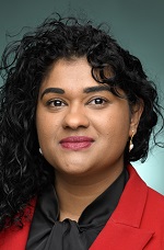
Division of Holt is a federal electorate in Victoria, covering about 252 km². Its federal member is Cassandra Fernando (Australian Labor Party). State electorates overlapping it include Bass, Cranbourne, Narre Warren South. Local council areas overlapping it include Casey City.
- Level
- Federal electorate
- State / territory
- Victoria (VIC)
- Area
- about 252 km²
- Federal member
- Cassandra Fernando — Australian Labor Party
- Official source
- AEC electorate profile
On Political Gadgets
State electorates overlapping Holt
| Bass (VIC state electorate) | 58% of this federal electorate | 11% of Bass |
| Cranbourne (VIC state electorate) | 25% of this federal electorate | >99% of Cranbourne |
| Narre Warren South (VIC state electorate) | 10% of this federal electorate | 64% of Narre Warren South |
Local council areas overlapping Holt
| Casey City | 95% of this federal electorate | 60% of Casey City |
Suburbs in Holt
Suburbs with at least a quarter of their area inside this federal electorate. Select one to see all three levels of electorate.
- Blind Bight 3980
- Botanic Ridge 3977
- Cannons Creek 3977
- Clyde 3978
- Cranbourne 3977
- Cranbourne East 3977
- Cranbourne North 3977
- Cranbourne South 3977
- Cranbourne West 3977
- Devon Meadows 3977
- Hampton Park 3976
- Junction Village 3977
- Lynbrook 3975
- Lyndhurst 3975
- Narre Warren South 3805
- Pearcedale 3912
- Tooradin 3980
- Warneet 3980
Questions
Who is the federal member for Holt?
Cassandra Fernando of the Australian Labor Party is the federal member for the Division of Holt in the House of Representatives.
Which council areas are in the Division of Holt?
Council areas overlapping it include Casey City.
Which state electorates are in the Division of Holt?
State electorates overlapping it include Bass, Cranbourne, Narre Warren South.
Which suburbs are in Holt?
Suburbs mostly inside it include Botanic Ridge, Cranbourne, Cranbourne East, Devon Meadows, Junction Village, Clyde, Cannons Creek, Hampton Park.
How accurate is this?
Boundaries are simplified (about 40 m tolerance), so overlap percentages are approximate. For anything official, such as enrolment or voting, check the Australian Electoral Commission or your state electoral commission.
← All federal electorates · Find My Electorates
Federal boundaries: Australian Electoral Commission (as at the 2025 federal election). State and council boundaries: incorporates or developed using Administrative Boundaries © Geoscape Australia licensed under CC BY 4.0.