Division of Herbert
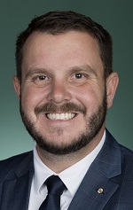
Division of Herbert is a federal electorate in Queensland, covering about 17,922 km². Its federal member is Phillip Thompson (Liberal National Party). State electorates overlapping it include Townsville, Burdekin, Hinchinbrook, Mundingburra. Local council areas overlapping it include Townsville City, Hinchinbrook Shire, Palm Island Aboriginal Shire.
- Level
- Federal electorate
- State / territory
- Queensland (QLD)
- Area
- about 17,922 km²
- Federal member
- Phillip Thompson — Liberal National Party
- Official source
- AEC electorate profile
On Political Gadgets
State electorates overlapping Herbert
| Townsville (QLD state electorate) | 69% of this federal electorate | 98% of Townsville |
| Burdekin (QLD state electorate) | 17% of this federal electorate | 3% of Burdekin |
| Hinchinbrook (QLD state electorate) | 14% of this federal electorate | 18% of Hinchinbrook |
| Mundingburra (QLD state electorate) | <1% of this federal electorate | 27% of Mundingburra |
Local council areas overlapping Herbert
| Townsville City | 52% of this federal electorate | 76% of Townsville City |
| Hinchinbrook Shire | 48% of this federal electorate | 75% of Hinchinbrook Shire |
| Palm Island Aboriginal Shire | <1% of this federal electorate | >99% of Palm Island Aboriginal Shire |
Suburbs in Herbert
Suburbs with at least a quarter of their area inside this federal electorate. Select one to see all three levels of electorate.
- Aitkenvale 4814
- Arcadia 4819
- Beach Holm 4818
- Belgian Gardens 4810
- Black River 4818
- Bluewater 4818
- Bluewater Park 4818
- Bohle 4818
- Bohle Plains 4817
- Burdell 4818
- Bushland Beach 4818
- Castle Hill 4810
- Condon 4815
- Cosgrove 4818
- Cranbrook 4814
- Currajong 4812
- Deeragun 4818
- Douglas (Townsville - Qld) 4814
- Florence Bay 4819
- Garbutt 4814
- Gulliver 4812
- Heatley 4814
- Hermit Park 4812
- Horseshoe Bay 4819
- Hyde Park 4812
- Jensen 4818
- Kelso 4815
- Kirwan 4817
- Lynam 4818
- Mount Louisa 4814
- Mount Low 4818
- Mount St John 4818
- Mundingburra 4812
- Murray 4814
- Mysterton 4812
- Nelly Bay 4819
- North Ward 4810
- Pallarenda 4810
- Palm Island 4816
- Picnic Bay 4819
- Pimlico 4812
- Railway Estate 4810
- Rangewood 4817
- Rasmussen 4815
- Rosslea 4812
- Rowes Bay 4810
- Saunders Beach 4818
- Shaw 4818
- Shelly Beach (Townsville - Qld) 4810
- South Townsville 4810
- Thuringowa Central 4817
- Toolakea 4818
- Town Common 4810
- Townsville City 4810
- Vincent 4814
- West End (Townsville - Qld) 4810
- West Point 4819
- Yabulu 4818
Questions
Who is the federal member for Herbert?
Phillip Thompson of the Liberal National Party is the federal member for the Division of Herbert in the House of Representatives.
Which council areas are in the Division of Herbert?
Council areas overlapping it include Townsville City, Hinchinbrook Shire, Palm Island Aboriginal Shire.
Which state electorates are in the Division of Herbert?
State electorates overlapping it include Townsville, Burdekin, Hinchinbrook, Mundingburra.
Which suburbs are in Herbert?
Suburbs mostly inside it include Arcadia, Beach Holm, Belgian Gardens, Black River, Bohle, Burdell, Bushland Beach, Castle Hill.
How accurate is this?
Boundaries are simplified (about 40 m tolerance), so overlap percentages are approximate. For anything official, such as enrolment or voting, check the Australian Electoral Commission or your state electoral commission.
← All federal electorates · Find My Electorates
Federal boundaries: Australian Electoral Commission (as at the 2025 federal election). State and council boundaries: incorporates or developed using Administrative Boundaries © Geoscape Australia licensed under CC BY 4.0.