Division of Curtin
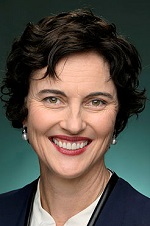
Division of Curtin is a federal electorate in Western Australia, covering about 103 km². Its federal member is Kate Chaney (Independent). State electorates overlapping it include Cottesloe, Nedlands, Churchlands, Scarborough. Local council areas overlapping it include City of Stirling, Town of Cambridge, City of Nedlands, City of Subiaco.
- Level
- Federal electorate
- State / territory
- Western Australia (WA)
- Area
- about 103 km²
- Federal member
- Kate Chaney — Independent
- Official source
- AEC electorate profile
On Political Gadgets
State electorates overlapping Curtin
| Cottesloe (WA state electorate) | 32% of this federal electorate | 87% of Cottesloe |
| Nedlands (WA state electorate) | 28% of this federal electorate | 93% of Nedlands |
| Churchlands (WA state electorate) | 27% of this federal electorate | >99% of Churchlands |
| Scarborough (WA state electorate) | 11% of this federal electorate | 62% of Scarborough |
Local council areas overlapping Curtin
| City of Stirling | 27% of this federal electorate | 27% of City of Stirling |
| Town of Cambridge | 21% of this federal electorate | 99% of Town of Cambridge |
| City of Nedlands | 19% of this federal electorate | >99% of City of Nedlands |
| City of Subiaco | 5% of this federal electorate | >99% of City of Subiaco |
| Town of Claremont | 5% of this federal electorate | >99% of Town of Claremont |
| City of Perth | 4% of this federal electorate | 23% of City of Perth |
| Town of Mosman Park | 4% of this federal electorate | >99% of Town of Mosman Park |
| Town of Cottesloe | 4% of this federal electorate | 98% of Town of Cottesloe |
| Shire of Peppermint Grove | 1% of this federal electorate | >99% of Shire of Peppermint Grove |
Suburbs in Curtin
Suburbs with at least a quarter of their area inside this federal electorate. Select one to see all three levels of electorate.
- Churchlands 6018
- City Beach 6015
- Claremont 6010
- Cottesloe 6011
- Crawley 6009
- Daglish 6008
- Dalkeith 6009
- Doubleview 6018
- Floreat 6014
- Glendalough 6016
- Herdsman 6017
- Innaloo 6018
- Jolimont 6014
- Karrakatta 6010
- Karrinyup 6018
- Mosman Park 6012
- Mount Claremont 6010
- Nedlands 6009
- Osborne Park 6017
- Peppermint Grove 6011
- Scarborough 6019
- Shenton Park 6008
- Subiaco 6008
- Swanbourne 6010
- Trigg 6029
- Wembley 6014
- Wembley Downs 6019
- West Leederville 6007
- Woodlands 6018
Questions
Who is the federal member for Curtin?
Kate Chaney of the Independent is the federal member for the Division of Curtin in the House of Representatives.
Which council areas are in the Division of Curtin?
Council areas overlapping it include City of Stirling, Town of Cambridge, City of Nedlands, City of Subiaco, Town of Claremont, City of Perth.
Which state electorates are in the Division of Curtin?
State electorates overlapping it include Cottesloe, Nedlands, Churchlands, Scarborough.
Which suburbs are in Curtin?
Suburbs mostly inside it include Churchlands, Claremont, Daglish, Dalkeith, Doubleview, Floreat, Herdsman, Jolimont.
How accurate is this?
Boundaries are simplified (about 40 m tolerance), so overlap percentages are approximate. For anything official, such as enrolment or voting, check the Australian Electoral Commission or your state electoral commission.
← All federal electorates · Find My Electorates
Federal boundaries: Australian Electoral Commission (as at the 2025 federal election). State and council boundaries: incorporates or developed using Administrative Boundaries © Geoscape Australia licensed under CC BY 4.0.