Division of Clark
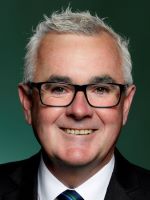
Division of Clark is a federal electorate in Tasmania, covering about 292 km². Its federal member is Andrew Wilkie (Independent). State electorates overlapping it include Clark. Local council areas overlapping it include Glenorchy City Council, Kingborough Council, Hobart City Council.
- Level
- Federal electorate
- State / territory
- Tasmania (TAS)
- Area
- about 292 km²
- Federal member
- Andrew Wilkie — Independent
- Official source
- AEC electorate profile
On Political Gadgets
State electorates overlapping Clark
| Clark (TAS state electorate) | >99% of this federal electorate | >99% of Clark |
Local council areas overlapping Clark
| Glenorchy City Council | 41% of this federal electorate | >99% of Glenorchy City Council |
| Kingborough Council | 32% of this federal electorate | 12% of Kingborough Council |
| Hobart City Council | 27% of this federal electorate | >99% of Hobart City Council |
Suburbs in Clark
Suburbs with at least a quarter of their area inside this federal electorate. Select one to see all three levels of electorate.
- Austins Ferry 7011
- Battery Point 7004
- Berriedale 7011
- Bonnet Hill 7053
- Chigwell 7011
- Claremont 7011
- Collinsvale 7012
- Derwent Park 7009
- Dowsing Point 7010
- Dynnyrne 7005
- Fern Tree 7054
- Glebe 7000
- Glenlusk 7012
- Glenorchy 7010
- Goodwood 7010
- Hobart 7000
- Kingston 7050
- Lenah Valley 7008
- Leslie Vale 7054
- Longley 7150
- Lower Longley 7109
- Lutana 7009
- Montrose 7010
- Moonah 7009
- Mount Nelson 7007
- Mount Stuart 7000
- Neika 7054
- New Town 7008
- North Hobart 7000
- Queens Domain 7000
- Ridgeway 7054
- Rosetta 7010
- Sandy Bay 7005
- South Hobart 7004
- Taroona 7053
- Tolmans Hill 7007
- Wellington Park 7054
- West Hobart 7000
- West Moonah 7009
Questions
Who is the federal member for Clark?
Andrew Wilkie of the Independent is the federal member for the Division of Clark in the House of Representatives.
Which council areas are in the Division of Clark?
Council areas overlapping it include Glenorchy City Council, Kingborough Council, Hobart City Council.
Which state electorates are in the Division of Clark?
State electorates overlapping it include Clark.
Which suburbs are in Clark?
Suburbs mostly inside it include Chigwell, Dynnyrne, Fern Tree, Glebe, Lenah Valley, Moonah, Mount Nelson, Mount Stuart.
How accurate is this?
Boundaries are simplified (about 40 m tolerance), so overlap percentages are approximate. For anything official, such as enrolment or voting, check the Australian Electoral Commission or your state electoral commission.
← All federal electorates · Find My Electorates
Federal boundaries: Australian Electoral Commission (as at the 2025 federal election). State and council boundaries: incorporates or developed using Administrative Boundaries © Geoscape Australia licensed under CC BY 4.0.