Division of Boothby
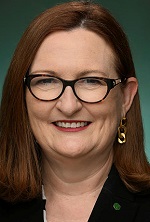
Division of Boothby is a federal electorate in South Australia, covering about 116 km². Its federal member is Louise Miller-Frost (Australian Labor Party). State electorates overlapping it include Waite, Elder, Gibson, Morphett. Local council areas overlapping it include City of Mitcham, City of Marion, City of Holdfast Bay, City of Unley.
- Level
- Federal electorate
- State / territory
- South Australia (SA)
- Area
- about 116 km²
- Federal member
- Louise Miller-Frost — Australian Labor Party
- Official source
- AEC electorate profile
On Political Gadgets
State electorates overlapping Boothby
| Waite (SA state electorate) | 34% of this federal electorate | 71% of Waite |
| Elder (SA state electorate) | 16% of this federal electorate | >99% of Elder |
| Gibson (SA state electorate) | 13% of this federal electorate | 99% of Gibson |
| Morphett (SA state electorate) | 9% of this federal electorate | 72% of Morphett |
| Black (SA state electorate) | 8% of this federal electorate | 37% of Black |
| Davenport (SA state electorate) | 6% of this federal electorate | 15% of Davenport |
| Badcoe (SA state electorate) | 5% of this federal electorate | 44% of Badcoe |
| Unley (SA state electorate) | 5% of this federal electorate | 33% of Unley |
| Heysen (SA state electorate) | 2% of this federal electorate | <1% of Heysen |
Local council areas overlapping Boothby
| City of Mitcham | 54% of this federal electorate | 83% of City of Mitcham |
| City of Marion | 32% of this federal electorate | 65% of City of Marion |
| City of Holdfast Bay | 12% of this federal electorate | 96% of City of Holdfast Bay |
| City of Unley | 2% of this federal electorate | 17% of City of Unley |
Suburbs in Boothby
Suburbs with at least a quarter of their area inside this federal electorate. Select one to see all three levels of electorate.
- Ascot Park 5043
- Bedford Park 5042
- Belair 5052
- Bellevue Heights 5050
- Black Forest 5035
- Blackwood 5051
- Brighton 5048
- Brown Hill Creek 5062
- Clapham 5062
- Clarence Gardens 5039
- Clarence Park 5034
- Clovelly Park 5042
- Colonel Light Gardens 5041
- Cumberland Park 5041
- Darlington 5047
- Daw Park 5041
- Dover Gardens 5048
- Eden Hills 5050
- Edwardstown 5039
- Glandore 5037
- Glenalta 5052
- Glenelg 5045
- Glenelg East 5045
- Glenelg North 5045
- Glenelg South 5045
- Glengowrie 5044
- Hawthorn 5062
- Hove 5048
- Kings Park 5034
- Kingston Park 5049
- Kingswood 5062
- Leawood Gardens 5150
- Lower Mitcham 5062
- Lynton 5062
- Marino 5049
- Marion 5043
- Melrose Park 5039
- Millswood 5034
- Mitcham 5062
- Mitchell Park 5043
- Morphettville 5043
- Netherby 5062
- North Brighton 5048
- O'Halloran Hill 5158
- Oaklands Park 5046
- Panorama 5041
- Park Holme 5043
- Pasadena 5042
- Plympton Park 5038
- Seacliff 5049
- Seacliff Park 5049
- Seacombe Gardens 5047
- Seacombe Heights 5047
- Seaview Downs 5049
- Somerton Park 5044
- South Brighton 5048
- South Plympton 5038
- Springfield 5062
- St Marys 5042
- Sturt 5047
- Tonsley 5042
- Torrens Park 5062
- Urrbrae 5064
- Warradale 5046
- Westbourne Park 5041
Questions
Who is the federal member for Boothby?
Louise Miller-Frost of the Australian Labor Party is the federal member for the Division of Boothby in the House of Representatives.
Which council areas are in the Division of Boothby?
Council areas overlapping it include City of Mitcham, City of Marion, City of Holdfast Bay, City of Unley.
Which state electorates are in the Division of Boothby?
State electorates overlapping it include Waite, Elder, Gibson, Morphett, Black, Davenport.
Which suburbs are in Boothby?
Suburbs mostly inside it include Ascot Park, Clapham, Clarence Gardens, Clarence Park, Clovelly Park, Colonel Light Gardens, Cumberland Park, Daw Park.
How accurate is this?
Boundaries are simplified (about 40 m tolerance), so overlap percentages are approximate. For anything official, such as enrolment or voting, check the Australian Electoral Commission or your state electoral commission.
← All federal electorates · Find My Electorates
Federal boundaries: Australian Electoral Commission (as at the 2025 federal election). State and council boundaries: incorporates or developed using Administrative Boundaries © Geoscape Australia licensed under CC BY 4.0.