Division of Blair
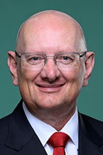
Division of Blair is a federal electorate in Queensland, covering about 6,471 km². Its federal member is Shayne Neumann (Australian Labor Party). State electorates overlapping it include Nanango, Scenic Rim, Ipswich West, Lockyer. Local council areas overlapping it include Somerset Regional, Ipswich City.
- Level
- Federal electorate
- State / territory
- Queensland (QLD)
- Area
- about 6,471 km²
- Federal member
- Shayne Neumann — Australian Labor Party
- Official source
- AEC electorate profile
On Political Gadgets
State electorates overlapping Blair
| Nanango (QLD state electorate) | 78% of this federal electorate | 28% of Nanango |
| Scenic Rim (QLD state electorate) | 7% of this federal electorate | 9% of Scenic Rim |
| Ipswich West (QLD state electorate) | 6% of this federal electorate | >99% of Ipswich West |
| Lockyer (QLD state electorate) | 5% of this federal electorate | 12% of Lockyer |
| Bundamba (QLD state electorate) | 2% of this federal electorate | 81% of Bundamba |
| Ipswich (QLD state electorate) | 1% of this federal electorate | >99% of Ipswich |
| Moggill (QLD state electorate) | <1% of this federal electorate | 20% of Moggill |
Local council areas overlapping Blair
| Somerset Regional | 83% of this federal electorate | >99% of Somerset Regional |
| Ipswich City | 16% of this federal electorate | 94% of Ipswich City |
Suburbs in Blair
Suburbs with at least a quarter of their area inside this federal electorate. Select one to see all three levels of electorate.
- Amberley 4306
- Ashwell 4340
- Atkinsons Dam 4311
- Augustine Heights 4300
- Avoca Vale 4314
- Banks Creek 4306
- Barellan Point 4306
- Basin Pocket 4305
- Biarra 4313
- Blacksoil 4306
- Blackstone 4304
- Booval 4304
- Borallon 4306
- Braemore 4313
- Brassall 4305
- Brightview 4311
- Bryden 4312
- Buaraba 4311
- Bundamba 4304
- Caboonbah 4312
- Calvert 4340
- Churchill 4305
- Chuwar 4306
- Clarendon 4311
- Coal Creek 4312
- Coalfalls 4305
- Colinton 4314
- Collingwood Park 4301
- Cooeeimbardi 4313
- Coolana 4311
- Coominya 4311
- Cressbrook 4313
- Crossdale 4312
- Deebing Heights 4306
- Dinmore 4303
- Dundas 4306
- East Ipswich 4305
- Eastern Heights 4305
- Ebbw Vale 4304
- Ebenezer 4340
- England Creek 4306
- Esk 4312
- Eskdale 4312
- Fairney View 4306
- Fernvale 4306
- Flinders View 4305
- Fulham 4313
- Glamorgan Vale 4306
- Glen Esk 4312
- Glenfern 4515
- Goolman 4306
- Grandchester 4340
- Gregors Creek 4313
- Haigslea 4306
- Harlin 4314
- Hazeldean 4515
- Ipswich 4305
- Ironbark 4306
- Ivory Creek 4313
- Jeebropilly 4340
- Jimna 4515
- Karalee 4306
- Karana Downs 4306
- Karrabin 4306
- Kholo 4306
- Kilcoy 4515
- Kingaham 4515
- Lake Wivenhoe 4311
- Lanefield 4340
- Lark Hill 4306
- Leichhardt 4305
- Linville 4314
- Lower Cressbrook 4313
- Lower Mount Walker 4340
- Lowood 4311
- Marburg 4346
- Minden 4311
- Monsildale 4515
- Moombra 4312
- Moore 4314
- Moores Pocket 4305
- Mount Archer (Somerset - Qld) 4514
- Mount Beppo 4313
- Mount Byron 4312
- Mount Crosby 4306
- Mount Forbes 4340
- Mount Hallen 4312
- Mount Kilcoy 4515
- Mount Marrow 4306
- Mount Mort 4340
- Mount Stanley 4314
- Mount Tarampa 4311
- Mount Walker West 4340
- Muirlea 4306
- Murrumba 4312
- Mutdapilly 4307
- New Chum 4303
- Newtown (Ipswich - Qld) 4305
- North Booval 4304
- North Ipswich 4305
- North Tivoli 4305
- One Mile 4305
- Ottaba 4313
- Patrick Estate 4311
- Peak Crossing 4306
- Pine Mountain 4306
- Prenzlau 4311
- Purga 4306
- Raceview 4305
- Redbank Creek 4312
- Redbank Plains 4301
- Rifle Range 4311
- Ripley 4306
- Riverview 4303
- Rosewood 4340
- Royston 4515
- Sadliers Crossing 4305
- Sandy Creek 4515
- Scrub Creek 4313
- Sheep Station Creek 4515
- Silkstone 4304
- Somerset Dam 4312
- South Ripley 4306
- Split Yard Creek 4306
- Spring Mountain 4300
- Springfield Central 4300
- Springfield Lakes 4300
- Swanbank 4306
- Tallegalla 4340
- Tarampa 4311
- Thagoona 4306
- The Bluff (Ipswich - Qld) 4340
- Tivoli 4305
- Toogoolawah 4313
- Vernor 4306
- Villeneuve 4514
- Walloon 4306
- Wanora 4306
- West Ipswich 4305
- Westvale 4514
- White Rock (Ipswich - Qld) 4306
- Willowbank 4306
- Winya 4515
- Wivenhoe Hill 4311
- Wivenhoe Pocket 4306
- Woodend 4305
- Woolmar 4515
- Woolshed 4340
- Wulkuraka 4305
- Yamanto 4305
- Yimbun 4313
Questions
Who is the federal member for Blair?
Shayne Neumann of the Australian Labor Party is the federal member for the Division of Blair in the House of Representatives.
Which council areas are in the Division of Blair?
Council areas overlapping it include Somerset Regional, Ipswich City.
Which state electorates are in the Division of Blair?
State electorates overlapping it include Nanango, Scenic Rim, Ipswich West, Lockyer, Bundamba, Ipswich.
Which suburbs are in Blair?
Suburbs mostly inside it include Amberley, Ashwell, Atkinsons Dam, Basin Pocket, Blacksoil, Blackstone, Booval, Borallon.
How accurate is this?
Boundaries are simplified (about 40 m tolerance), so overlap percentages are approximate. For anything official, such as enrolment or voting, check the Australian Electoral Commission or your state electoral commission.
← All federal electorates · Find My Electorates
Federal boundaries: Australian Electoral Commission (as at the 2025 federal election). State and council boundaries: incorporates or developed using Administrative Boundaries © Geoscape Australia licensed under CC BY 4.0.